|
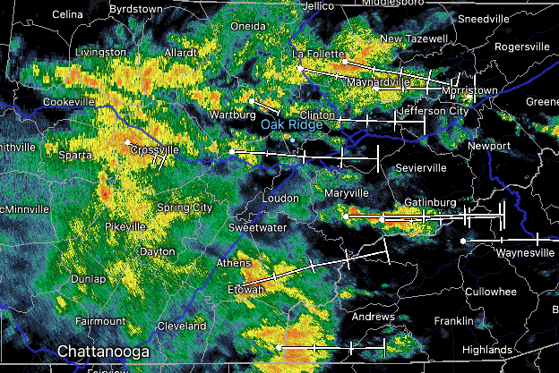
Showers are filling in, where widespread activity is seen early this afternoon. Rainfall rates are moderate, but a few pockets of heavy showers are likely as this moves through. We do have a Marginal risk of Flash Flooding today, but with rates doable, issues should be few and far between. That said, most locations have picked up between 1-3" with most in the 2-3 inch range. Moving forward, this swath of showers will move through this afternoon, with activity becoming more spotty this evening and overnight. A warm front is building north so highs today and tomorrow will be above average in the 60s. Into tomorrow, a low pressure system will make its way in, bringing an associated cold front with it. Showers will ramp back up towards tomorrow evening and continue into early Friday. Once the front passes, briefly drier and cooler air will follow Friday afternoon and through a portion of the weekend. Isolated shower chances then return Sunday, with better chances into the new work week. This soggy weather pattern doesn't look like it'll be changing anytime soon, as outlooks depict another 1-2+ inches possible over the next 7 days. The good news is temperatures look to hang at to above average through this time. As always, we will be here to provide the latest, so don't forget to give us a follow on Twitter and Facebook @SecretCityWx Pre-recorded for 5pm weather broadcast
0 Comments
Leave a Reply. |
Your trusted source for everything weather in East Tennessee.
Social Media
|


