|
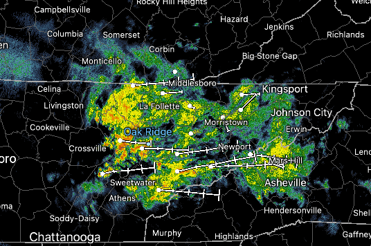
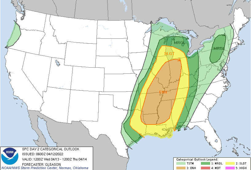
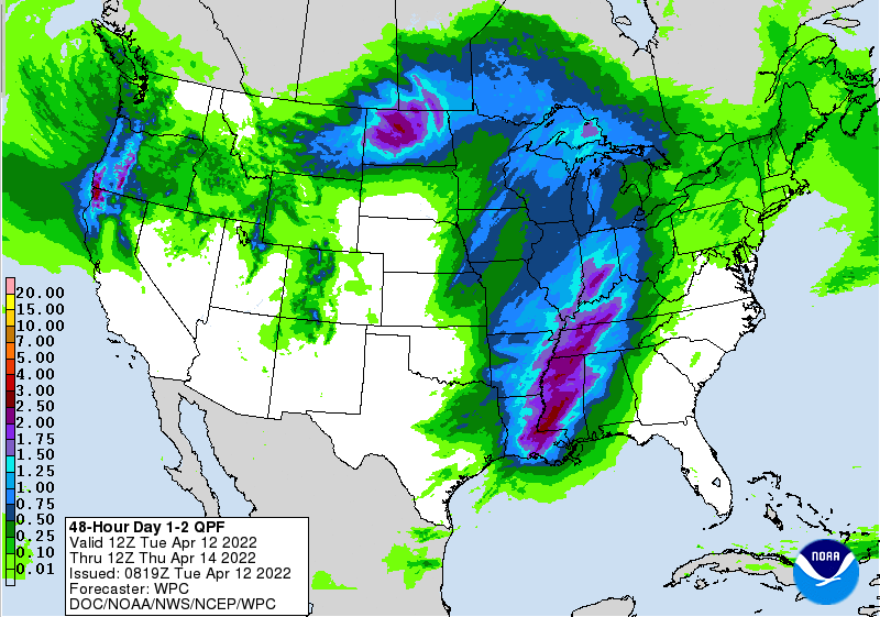
Showers and a few rumbles of thunder start out the day, but will diminish over the next few hours. This will set up for a mostly cloudy day with highs in the low to mid 70s. With a frontal boundary lifting north as a warm front tomorrow, a cold front will eventually swing in from the west. This will be the focus for a line of showers and thunderstorms (some strong to severe) to work in late Wednesday. Looking at the Day 2 severe threat, the SPC highlights a Slight risk for portions of the Plateau, while a Marginal is in place for the remainder of East Tennessee. The good news is this line will weaken with the eastward shift. This doesn't mean strong to marginally severe storms are completely ruled out, just the opportunity for stronger storms is not great. Nonetheless, have a way to receive alerts if warnings are issued. This is tricky, as activity does come during the night while many are asleep. The biggest threat will be damaging winds gusts but an isolated area of spin up can't be ruled out. As far as rain, the heaviest bands will set up west. East Tennessee can anticipate between half an inch in the far east to upwards of an inch and a quarter in the Plateau through Thursday morning. Activity should move out by mid morning Thursday, with sunshine slowing working back in for Friday. Unfortunately, this does not last long as spotty showers and cloud cover make a return Saturday. That will do it for today. The big take away is having an umbrella close by the next several days. With a few spotty showers today, showers and storms late tomorrow and into Thursday morning, and again this weekend, it would be a good idea! Temperatures will also be warm, with highs tomorrow in the 70s and 80s, and continuing to stay in the 70s through the end of the week. Pre-recorded for 5pm show
0 Comments
Leave a Reply. |
Your trusted source for everything weather in East Tennessee.
Social Media
|


