|
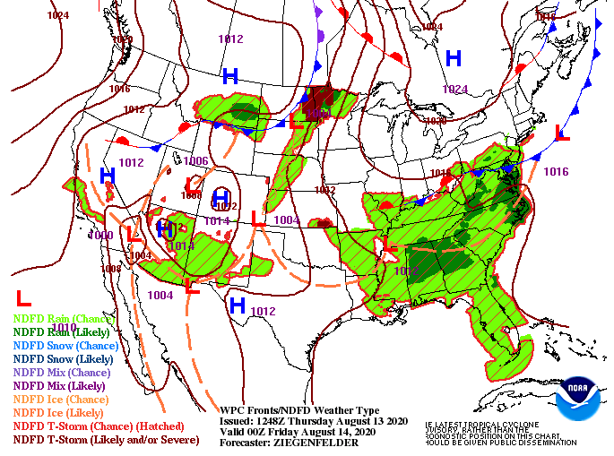
Good afternoon! A look at the latest release for drought conditions across the state shows more negatives than positives. Southeastern TN has increased to moderate drought conditions while the remainder stay idle in abnormally dry. Cooler and drier air is anticipated longer term, so we'll likely see things intensify in the weeks ahead. As for now, conditions this afternoon will be similar to yesterday. We were anticipating a bit more activity today but with the system moving very slow, most of the "action" will come Friday. As you can see below, a low is stationed in far western TN. As this works east, showers & a few storms will develop throughout the later half of Friday. As depicted from the surface map, showers and storms will come from the east, developing by the afternoon and evening hours tomorrow. Activity will be scattered at times, but generally speaking, anticipate up to half an inch in your area. Amounts will vary in heavier cells. Additional scattered showers will work through Saturday before drier air arrives Sunday. In addition to some much needed rainfall, high's will drop into the mid 80's through the weekend. A little gift from Mother Nature is in the long term forecast, so be sure to watch out daily forecast below for more details. Be sure to stay cool again this afternoon and keep the umbrellas handy tomorrow. Showers will likely begin firing off in the afternoon and continue into the overnight hours.
0 Comments
Leave a Reply. |
Your trusted source for everything weather in East Tennessee.
Social Media
|


