|
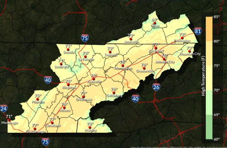
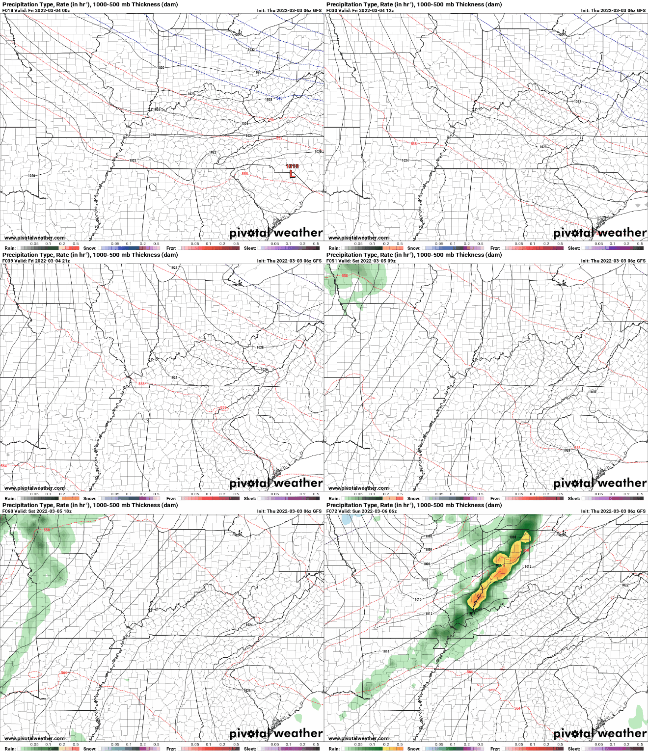
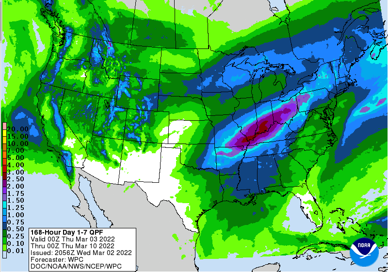
Another Spring-like day is on tap, with highs today in the upper 60s and low 70s. Check out the forecast as we work into the weekend though. Highs Sunday can be seen below, but Saturday won't be too far from these values either. Keep in mind, the record high in Knoxville (as it stands now) on Sunday is 79 degrees. As we move forward, a wavering frontal boundary will bring several things. First, slightly cooler air for Friday. By cooler, you can anticipate highs Friday to remain in the upper 60s to low 70s. As an area of low pressure develops along it, this boundary will build north in the form of a warm front (Saturday and Sunday). As it does so, warm moisture rich air will filter in. This will increase cloud cover and lead to isolated showers at times late Saturday and again at times Sunday. By Monday, a cold front will begin inching in from the west and bring the opportunity for widespread showers and possibly a thunderstorm. Cooler and drier air will then follow for Tuesday. After a dry and warm week, a transition back to an active pattern is set. The rainfall outlook over the next week suggests upwards of an inch across East Tennessee, but much higher amounts to our north and west. Another pleasant, warm, and sunny day is set so take advantage if you can! Don't forget to watch our video forecast below as well as follow us on Twitter & Facebook (@SecretCityWx) Pre-recorded for 5pm show
0 Comments
Leave a Reply. |
Your trusted source for everything weather in East Tennessee.
Social Media
|


