|
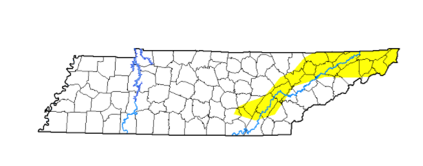
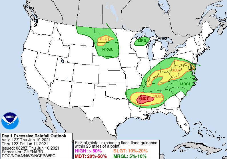
We'll start off by highlighting improvements across East Tennessee as it relates to the abnormally dry conditions that have been present the past couple of weeks. Most of these locations have now been confined to the Plateau and into the far northeast corner. I anticipate with the added rainfall this week/weekend we'll continue to see slight improvement this time next week as well. Some good news as it relates to the flooding threat. The WPC has dialed back their flash flood threat to a Marginal risk (5-10%). There was a slight in place from this time yesterday but with areas not hit as hard yesterday, this has been reduced some. Nonetheless, flash flooding remains a possible, especially if heavy showers materialize and work through similar locations. This could lead to "training" and the likelihood for flood and flash flooding conditions. This Marginal is in effect for both today and tomorrow (as of now). A play-by-play shows showers and storms developing this afternoon before again dissipating overnight. Better and more widespread showers are in store for Friday as a trough dips to our east. Activity will carry into Saturday as well before much needed sunshine begins edging back in Sunday and early next week. That will do it for today. Have a way to receive alerts, especially if you are in flood prone areas. Heavy showers and storms will be possible through Friday evening before conditions gradually improve towards the end of the weekend. Pre-recorded for 5pm show
0 Comments
Leave a Reply. |
Your trusted source for everything weather in East Tennessee.
Social Media
|


