|
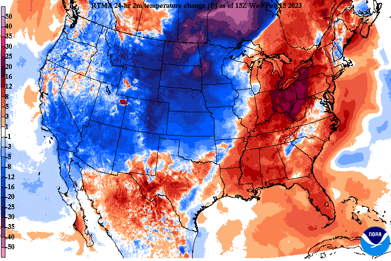
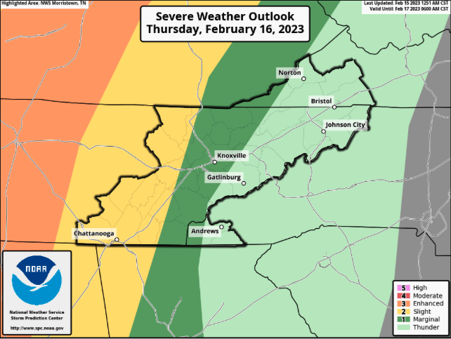
A warm one here on this Wednesday and it will remain that way again tomorrow. A warm front is expected to meander north overnight, keeping overnight lows well above average for this time of the year. This will also allow for our first batch of showers/storms to overspread the area. As far as through the afternoon today, generally cloudy and warm. A few isolated to scattered showers will be possible towards the evening, with better potential overnight. With the low and associated cold front drawing closer late tomorrow, the risk for strong and severe storms will be possible. There is still some timing concerns, which will play a role in the outcome, so stay close for updates. As it sits now, the bulk of strong to severe storms will stay contained to Middle Tennessee, but a few longer lasting cells could bring damaging winds to the Plateau and into the Central Valley late tomorrow afternoon and evening. If this line ends up moving a bit quicker, a higher risk of storms will be possible versus a slower progression and lesser chance. Either way, the primary risk will be damaging wind gusts. Looking at the progression of all this, our first round pushes northward overnight and into Thursday morning, before a brief pause in activity finds us into the middle of the day. As the trailing cold front then shifts east, a line of strong to severe storms takes shape west. This line will glide east weakening as it does so. Again timing will play a role, as a quicker progression could allow for stronger storms while a slower one would lessen those odds. Stay weather aware tomorrow as both strong to severe storms and flash flooding will be possible. Once the cold front slides through late tomorrow, much colder air filters in Friday. Highs will only top out in the upper 30s to low 40s, before a gradual warm up through the weekend. Plenty of sunshine finds the area Saturday and Sunday. Pre-recorded for 5pm weather broadcast
0 Comments
Leave a Reply. |
Your trusted source for everything weather in East Tennessee.
Social Media
|


