|
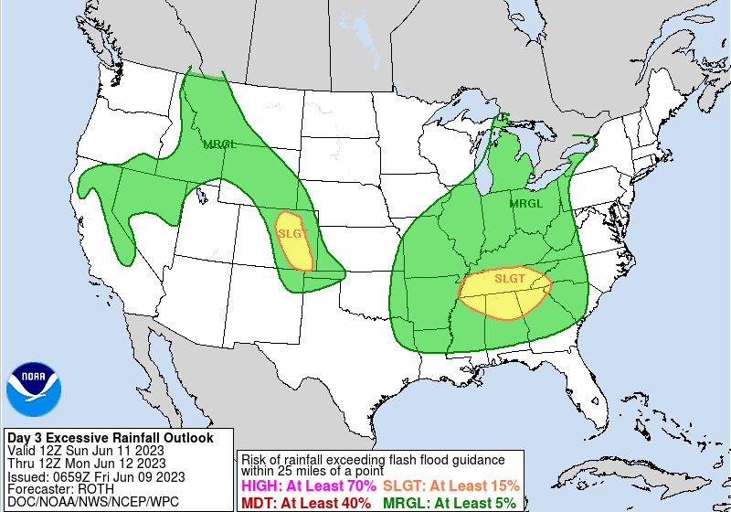
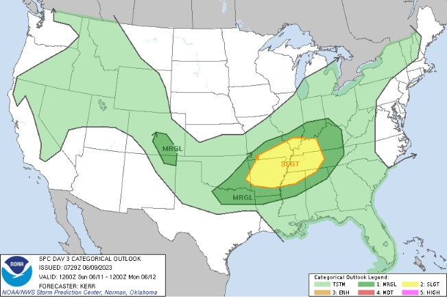
Other than some patchy fog lifting out this morning, we start cool and crisp for early to mid June standards. Fortunately, we will warm nicely into this afternoon, with highs topping out in the upper 70s to low 80s under mostly sunny skies. Dry weather will stick around through Saturday, before showers & storms return Sunday into Monday. Analyzing the threats, a Slight risk of flash flooding is in place across much of the state. WPC suggests this to be a higher end potential given some guidance, but for now, I am downplaying this myself. Reason being, some of the suggested guidance are more outliers when compared to the mean, we are running fairly dry in many spots (with drought across many East TN locations), and the better support is further west. That said, isolated heavy rainfall within storms could lead to an instance or two of flash flooding and it is a threat we need to keep in mind Sunday afternoon into the night. Additionally, a risk for severe storms is present (1/5 on the risk scale). Again, the better support will be further west, but a few strong storms will be possible Sunday afternoon to evening where strong to damaging wind gusts are the primary concern. Of the two threats, I believe the severe threat is of a higher potential, though national federal centers obviously differ in this opinion. We will see as better guidance comes in today and Saturday, so tune back in to our social media for the latest. Temperatures will fall down into the 70s to low 80s Monday with the passing front, where briefly drier air returns Monday night. This won't last too long though, as isolated to scattered shower/storm chances will be possible each afternoon to evening this upcoming week. Check out our Twitter/Facebook page (@SecretCityWx) along with our video forecast below for more. Pre-recorded for 5pm weather broadcast
0 Comments
Leave a Reply. |
Your trusted source for everything weather in East Tennessee.
Social Media
|


