|
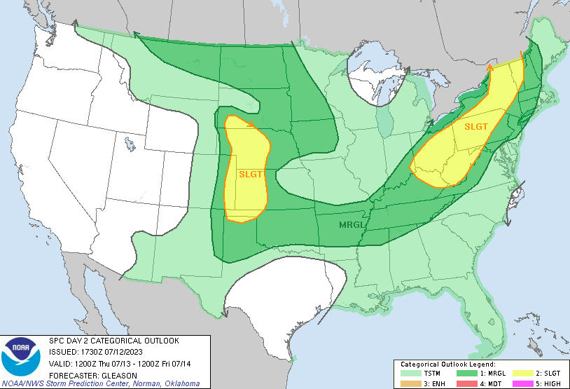
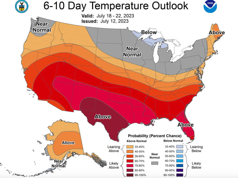
Good morning! I will start by highlighting the severe risk/threat we have today. An approaching and slow moving cold front will bring the opportunity for both strong storms and heavy rainfall. The timing for this activity will come later this afternoon through the early overnight hours, where damaging wind gusts are the primary threat, but isolated large hail is also possible. In addition to the marginal severe risk, a marginal flash flooding risk (not shown) is also present. Within slow moving and stronger storms, the chances will be highest. Any locations that see several rounds of rainfall will also be at a much higher risk. Be weather aware not only today but through the weekend as well. A simulated run of what could happen today, shows isolated activity beginning to pop up early to mid afternoon, with increasing chances this evening into early tonight. Though this isn't exactly what will occur, the idea remains the same. Shower and storm chances will increase with time, with activity starting as early as the lunch time hour. Renewed threats for showers and storms then follow Friday, Saturday, and Sunday with the best chances during the afternoon and evening hours. Saturday will again be a higher alert day, as strong to severe storms and flash flooding will be a possibility (higher threat than Friday and Sunday). Outside of the short-term period, a look further out suggests much of the same. Seasonably warm air and (not shown) near normal rainfall is expected as we swing into the second half of the month. Activity will more than likely be our summer classic: afternoon pop up showers and storms, but better chances will be at play with passing low pressure systems as well. That will wrap it up for today, be sure to check us out and follow along on Twitter and Facebook if you don't already. You can always stay up to date on our radar tab at the top of the page as well. Stay safe, stay cool, and have a good one!
0 Comments
Leave a Reply. |
Your trusted source for everything weather in East Tennessee.
Social Media
|


