|
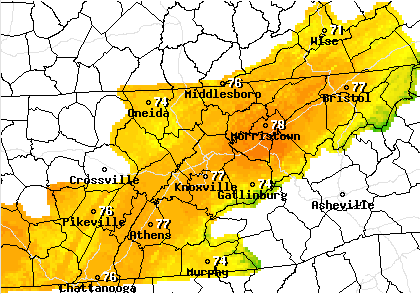
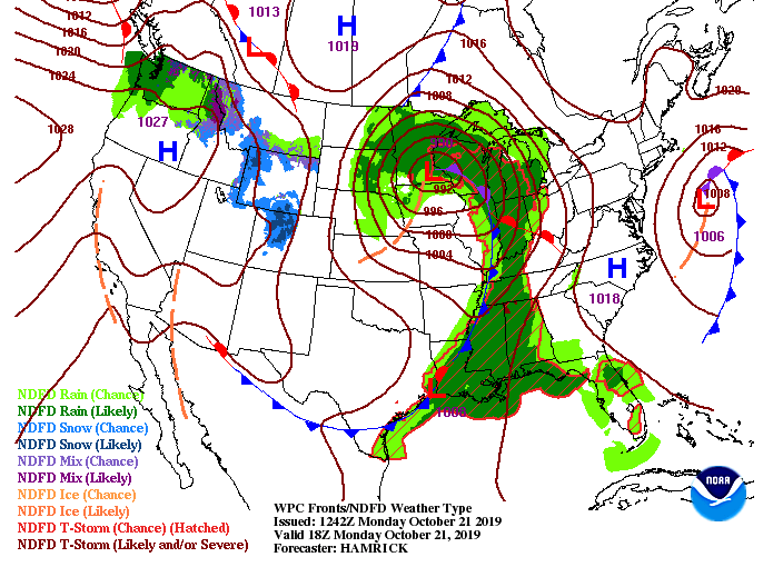
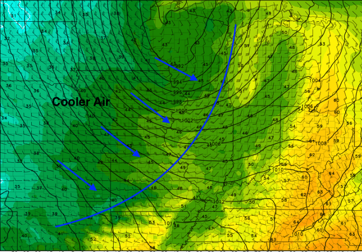
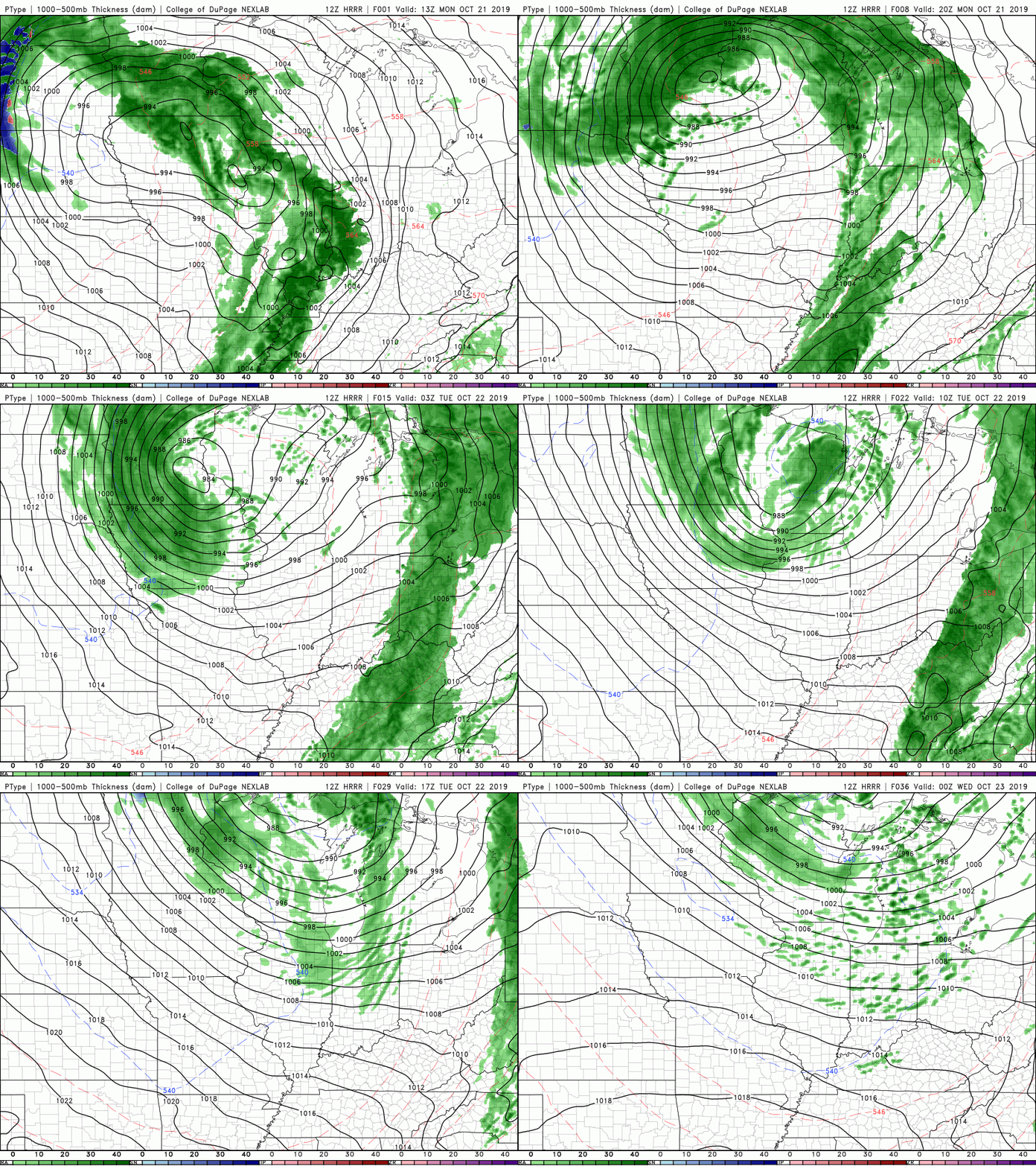
What a gloomy start to the new work week with fog across the area. It has begun lifting, but clouds are working in from the west. For this afternoon, we will be looking at high's in the mid 70's and mostly cloudy. To get a better idea of what is going on, a parent low to the north will extend a cold front out, providing showers and storms tonight and into early Tuesday. Cooler air will also begin backing in from the north allowing highs in the 60's both Tuesday and Wednesday before we begin warming back up to near average temperatures, Thursday. This snip-it at midnight tonight shows the cold front still off to the west. Ahead of it, showers and storms will move through into the early hours of Tuesday. Anticipate cooler temperatures back in the 60's both Tuesday and Wednesday and low's back in the low to mid 40's each evening. Model guidance depicts the showers/storms overnight tonight. With this system arriving overnight, it lessons the potential for any severe development, meaning good sleeping weather is expected. Nonetheless, any severe development will likely occur in the Plateau before the system weakens as it moves east. Overall rain totals tonight will be between half an inch to an inch. Higher totals are possible in thunderstorms, but generally, 0.5-1 is anticipated. This will help the overall drought we have been dealing with, but are still in need of more rain to correct the issue. Expect clearing skies Tuesday with high's in the mid 60's by the afternoon. Thats a wrap for your Monday forecast, but be sure to stay up to date on our Twitter: @SecretCityWx for the latest updates on tonight's showers and storms.
0 Comments
Leave a Reply. |
Your trusted source for everything weather in East Tennessee.
Social Media
|


