|
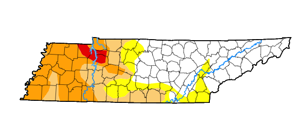
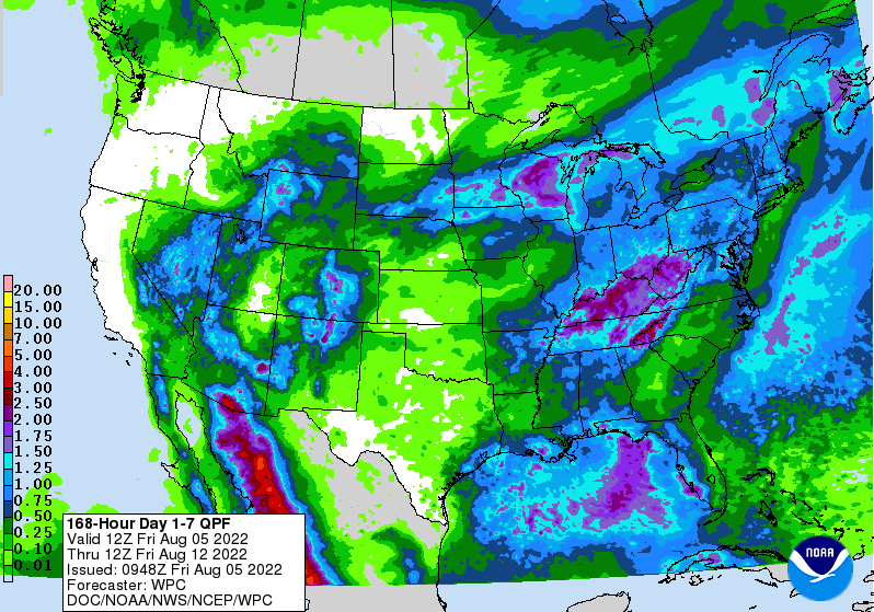
We will start off with positive news! In terms of the drought-front, we have improved this week. Not only has East Tennessee fully recovered, but West Tennessee has also shown signs of improvement. Check out the latest conditions (figure 1) compared to the prior week (figure 2) Back to the unfortunate reality ahead though, showers and storms look to ruin afternoon plans for at least the next 5-7 days. Given the warm and muggy airmass in place, as well as the current atmospheric pattern, daily showers and storms should be expected. With that said, there will be breaks with the most opportune time in the morning and at night. Showers and storms will be best during the afternoon and evening hours each day, with the better potential today and tomorrow, and then again next Tuesday and Wednesday. By late next week, high pressure looks to fill back in bringing some much needed drier conditions. Check out expected 7-day rainfall totals below. As mentioned, the best rainfall potential will fall later today and again tomorrow. The bulk looks to fall across Middle Tennessee and into Kentucky, but high-res guidance depicts activity picking up for us overnight tonight. This could pose some issues with flash flooding potential, as we are under a Marginal Risk today and tomorrow. Really any thunderstorm over the next week will have the potential to be strong and bring localized heavy downpours. Keep this in mind moving forward, with another good shot of rain Tuesday & Wednesday with the arrival of a cold front. Check out our graphical forecast under the "5-Day Forecast" tab at the top of the page for more information! That will do it for today...another warm and muggy one is in store, with highs in the mid 80s to around 90 degrees. We gradually trend cooler moving forward, but rain chances continue. Have a great weekend, and don't forget to catch us on Twitter and Facebook for the latest updates (@SecretCityWx) Pre-recorded for 5pm weather broadcast
0 Comments
Leave a Reply. |
Your trusted source for everything weather in East Tennessee.
Social Media
|


