|
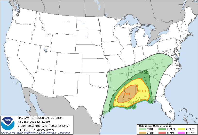
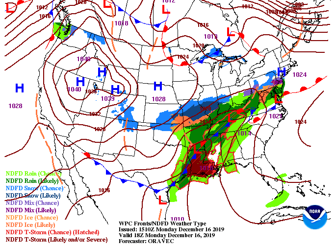
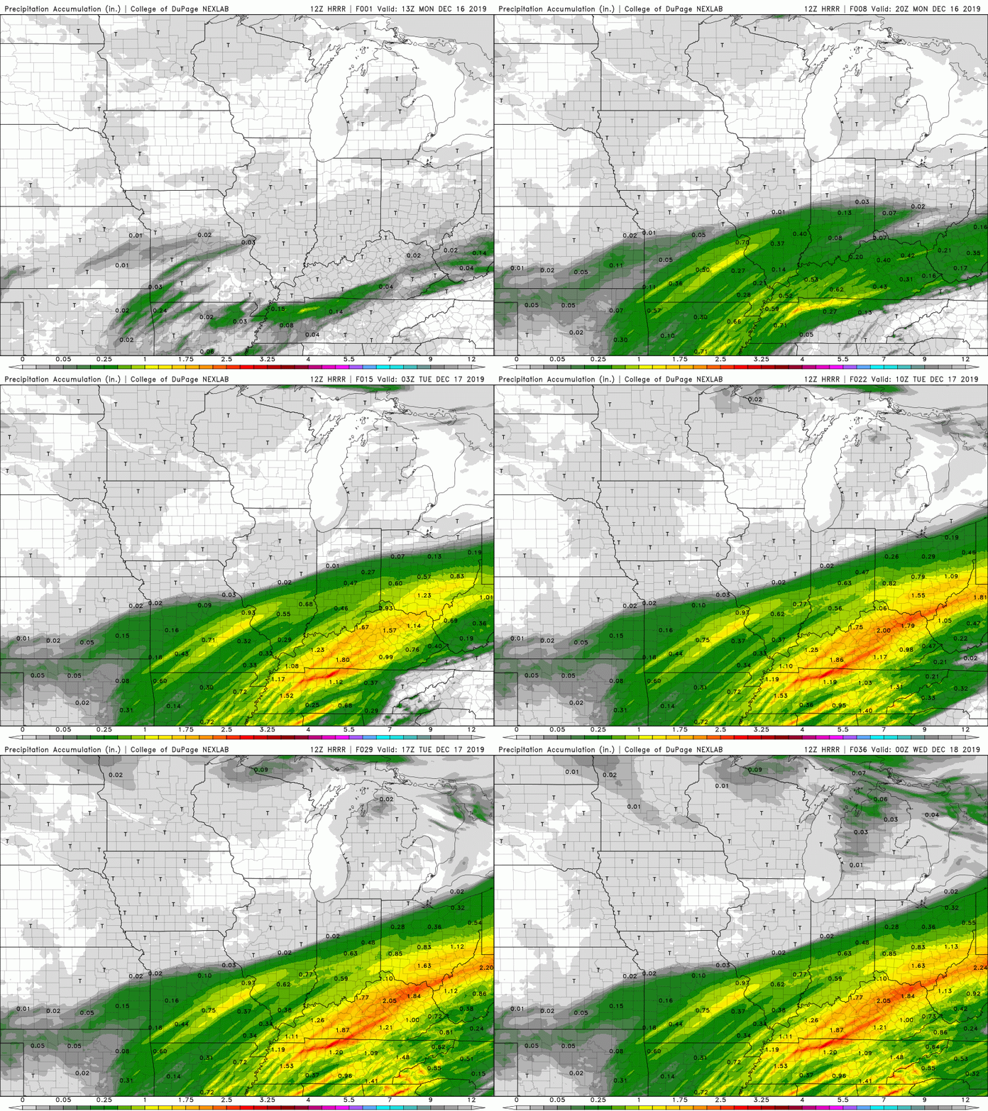
A warm southern breeze behind a warm front (to the north) has forced temperatures into the upper 60's for the lunch time hour. Record-wise, Tyson McGhee has a high temperature on this day of 71 degrees (set back in 1929). We will likely see that broken this afternoon so stay tuned! As for the graphic below, here is the latest from the SPC (Storm Prediction Center). Though severe potential is very limited in east TN, the area most likely to feel stronger thunderstorms (and even isolated tornadoes) this evening is in the Plateau (marginal risk). For the valley and to the east, gusty winds, heavy downpours, and rumbles of thunder are all possible tonight. As you can see from the surface map below, a warm front extended just to the north is allowing for a warm southern surge of temperatures and moisture. By this time tomorrow, rain will be out of the area and temperatures will be cooling quickly. A high will move overhead mid week keeping things cool and mostly sunny. Model guidance shows the timing of this system arriving between 8 and 11 tonight. Even with severe potential very low, don't rule out gusty winds, heavy downpours, and thunder at times. As we get into Tuesday morning, showers will thin out leaving us dry by the afternoon. Clouds will also decrease along with decreasing temperatures behind a cold front. Rain totals will be around an inch for most with locally higher amounts in heavier thunderstorms overnight. Areas of the Plateau and southern Kentucky are under a Flash Flood Watch, so continue staying Weather Aware. With our high Tuesday coming in the morning, don't forget your jackets out of the door. We are anticipating temps in the low 40's for the evening commute tomorrow so be sure to stay warm! As always, stay up to date via social media (Twitter & Facebook) for the latest and have a good one.
0 Comments
Leave a Reply. |
Your trusted source for everything weather in East Tennessee.
Social Media
|


