|
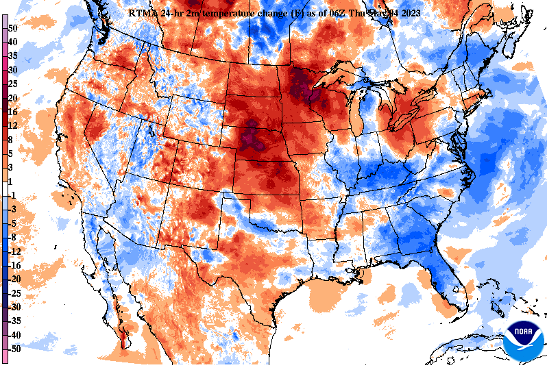
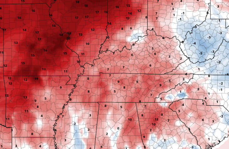
Good Thursday morning! I hope you are bundled up, as it's a chilly one across the Volunteer State. Temperature readings vary from the mid 30s to around 40 degrees. Thankfully, this will be our last sub-40 degree start for some time, maybe even until the Fall. Nonetheless, we are between 5 and 10 degrees cooler than Wednesday morning (as shown below). Moving through the day, cloud cover will gradually increase, with temperatures also on the rise. Highs should top out in the upper 60s to low 70s, making it feel much more comfortable than many days earlier in the week. Our next disturbance takes aim tomorrow into the weekend, posing a lower end flash flood threat. This slow moving system will drag a warm front east, sagging just south of the area. Because of this, moisture will pool along and ahead of the feature bringing showers and storms at times the second half of the day Friday into Saturday. With the boundary in place and thunderstorms on the table, instances of flash flooding can't be ruled out. The risk is fairly low, but any heavy and slow moving thunderstorms or areas of repeated activity will be the most susceptible to flooding. As such, have a way to receive watches and or warnings if they were to be issued. Friday night into Saturday will be the best timeframe for any heavy rainfall, with total amounts between 0.5-1.5" Friday through Saturday. Locally higher amounts will be possible. Lingering showers will then follow Sunday, before another disturbance brings another shower threat early next week. The good news during this time will be the temperatures. After a seasonably cool start the first half of the week, warmer air is en route. Highs will warm to the 80s by Sunday afternoon, continuing into early next week. This will be 5-7 degrees above average by Monday, as our usual high is around 76 to 77. That will conclude it for today, but remain weather aware as we work tomorrow evening through Saturday. Showers or storms could pose a threat for heavy rains which could lead to isolated instances of flash flooding. Have a good one, enjoy the warmth, and stay dry as showers and storms find the area. Pre-recorded for 5pm weather broadcast
0 Comments
Leave a Reply. |
Your trusted source for everything weather in East Tennessee.
Social Media
|


