|
Radar shows a few isolated showers working through parts of Morristown, Greeneville, and Jonson City but these are quickly moving east as we get into the afternoon. Looking ahead, the day 2 SPC outlook (Wednesday am to Thursday am) a slight risk remains in effect for much of TN and KY. We are looking at the timing for this line to work through overnight Wednesday and early into Thursday. The primary threats will be damaging winds and hail but isolated tornadoes can't be ruled out either. 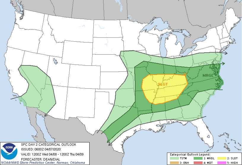 The latest surface map helps depict the setup of this unsettling weather. A low pressure system to the north will work its way east as a trailing cold front develops. Ahead of this cold front is where we will see the best chance for strong shower/storms. Once the cold front works through (late Thursday morning), we'll begin to dry out, clear out, and cool back off. 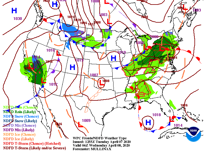 Similar to yesterday, a few isolated showers are possible throughout the afternoon today. We will stay calm overnight with showers and storms redeveloping into Wednesday. As a cold front works in to the north, stronger showers & storms will develop to the west. As we progress through the later half of the day Wednesday and into early Thursday, expect this line to move through the area. Be weary! This (weakening*) line will work through while many of us are in bed so have a way to receive alerts and take the proper precautions if things do become severe.  Looking ahead into mid-April, much cooler air is expected to work in. This is important for those in the agricultural sector as frost and freezing temperatures are something we'll be keeping a close eye on. If you want more details into the timing, how long this will last, and when the most ideal time to plant will be, shoot us an email at [email protected] or check out our services tab at the top of our website. 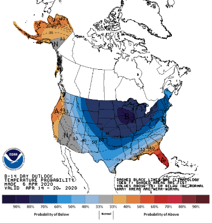 That does it for today...enjoy another warm and mild afternoon and check in for updates tomorrow as severe potential is something on our radar.
0 Comments
Leave a Reply. |