|
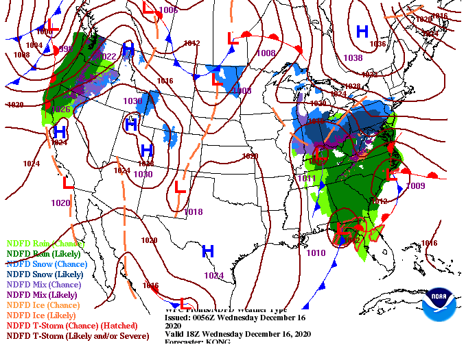
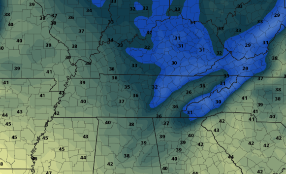
If you have yet to leave the house be sure to pack the umbrella with you this morning. Showers are currently falling across the area with a some pockets on the Plateau and Smokies picking up some snowfall. A look at the surface map below shows a low working through in a northeast fashion. Showers will be likely the first half of the day with cold air to follow into Thursday. Model guidance continues to suggest some areas (the Plateau, Smokies, and higher elevations of northern TN) will pick up some snowfall this evening/overnight. Accumulations will be very limited with anything significant areas too high in the mountains for any worry (unless you plan to hike/camp/etc.) As we get into Thursday, things will be cold and cloudy. Gradual clearing will take place through the day with sunshine by Friday. Again, this won't last long as another (weaker) system works through Saturday into early Sunday. Aside from the showers we see today, the biggest risk will be the cold temperatures tomorrow. Overnight low's tonight will drop to around freezing, leaving the chance for patchy black ice on elevated surfaces and bridges/overpasses early tomorrow morning. Unfortunately, things don't look to warm up much with high's tomorrow in the upper 30's. The plateau and Smokies will be lucky to surpass freezing (32) so have the Winter jackets ready! Make sure to grab the umbrella out of the door as we'll see showers through early this afternoon. Things begin tapering off and moving out by this evening with colder air to follow for Thursday. As I am sure you have seen, Secret City Weather has opening sponsorship opportunities for anyone in and around the area. For more information on what options are available visit SecretCityWeather.com/sponsors or email us directly at [email protected] Pre-recorded for 5pm show
0 Comments
Leave a Reply. |
Your trusted source for everything weather in East Tennessee.
Social Media
|


