|
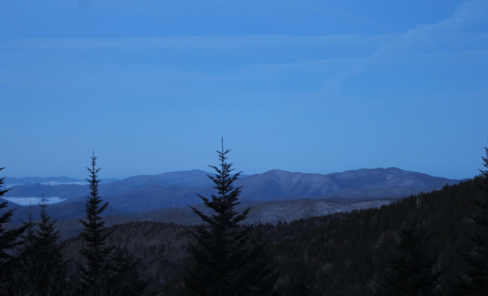
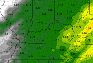
As the cloud cover from overnight slides eastward and out of the area, check out the views on top of Clingmans Dome. Things are a bit chilly here in the valley at 33 but a few thousand feet above us, Clingmans Dome currently sits in the 20's. As we progress into today, take advantage of the sunshine. Temperatures will also likely be the warmest of the work week (near 50) with much cooler air in store Wednesday and Thursday. Taking a look at our next weather maker, a system to our south and west will slide in overnight tonight. With low's expected to be in the low to mid 30's, some mixing will be likely to begin the day Wednesday. Unfortunately, accumulations will be very limited (staying to the higher elevations). As the sun rises Wednesday, warming will take place, transitioning any snow/frozen matter back to liquid precipitation. Rain showers are likely the first half of the day before becoming more scattered by the afternoon and evening. A trailing cold front will drop temperatures to the 30's for high's on Thursday, so bundle up! Sunny skies plan to return for Friday before a weak system pushes through for the weekend. A look at the rain maker overnight tonight and through tomorrow, we aren't expecting a huge washout. Model guidance is hinting at anywhere between a quarter and half an inch. Higher amounts are likely for the higher elevations as upsloping takes place. This will also be the most likely areas of snow accumulation. Overall, this will be another good opportunity to see a few flakes flying as well as keep any potential drought conditions at bay. Enjoy the sunshine we see today because it won't last long. Snow, rain, and much cooler air are on the way midweek before warmer temperatures and sunshine finish us out on Friday. We also are accepting sponsors for the second annual Secret City Weather East Tennessee Almanac. More information can be found at: SecretCityWeather.com/Sponsors Pre-recorded for 5pm show
0 Comments
Leave a Reply. |
Your trusted source for everything weather in East Tennessee.
Social Media
|


