|
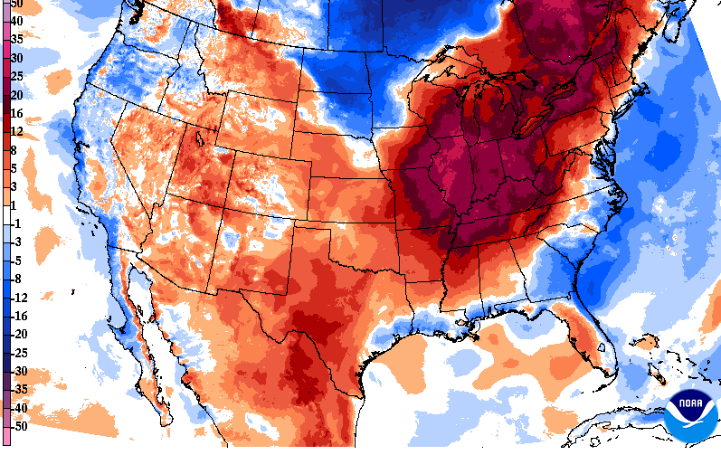
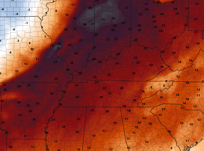
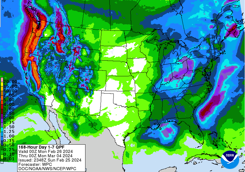
Good morning! We are off to a very warm start, with morning temperatures in the mid 40s to low 50s (well above average). This can be thanked to the "blanket" of low clouds beginning to scatter out- eventually resulting in plenty of sunshine by lunch time. With a very warm air mass in place, anticipate little changes between the above average start and highs this afternoon, with many pushing 15 to even 20 degrees above the norm. High temperatures to peak in the mid to upper 60s today and last in this range through midweek. In fact, looking below, you can see how warm things are expected to be compared to average. This snippet from guidance indicates we could be as warm as 15-20+ degrees above the norm Wednesday afternoon. Keep in mind our usual average for late February are the lower 50s and we'll be averaging values closer to mid April numbers. The good news is a "big" cool down is in store, bringing us temperatures around average by Thursday and Friday. Speaking of that cool down, a series of disturbances look to bring rainfall first. Isolated to scattered showers find us late tonight through Tuesday, followed by the approaching cold front Wednesday into Thursday. This later (Wed-Thu) system is expected to bring widespread showers and possibly a rumble of thunder, along with a brief wintry mix chance on the tail-end of things. Breaking it down further, the frontal boundary will slide east, resulting in breezy and widespread showers Wednesday into Wednesday night. As colder air funnels in behind the boundary, lingering moisture could be in the form of a rain/snow mix or isolated snow/flurries. Impacts are not expected across valley locations at this time, but the higher terrain could see some white stuff to start off the day Thursday. That will do it for today...Enjoy one last day of dry conditions, above normal temperatures, and sunshine because unsettled weather followed by cooler temperatures arrive tomorrow through the end of the work week.
0 Comments
Leave a Reply. |
Your trusted source for everything weather in East Tennessee.
Social Media
|


