|
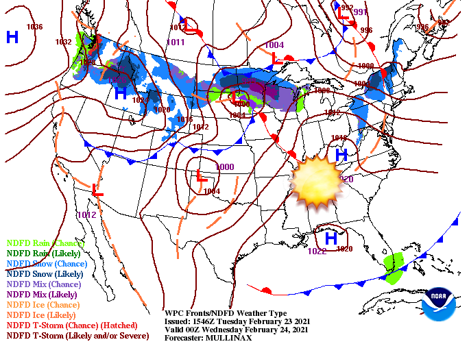
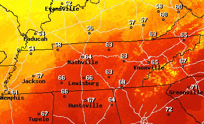
Knoxville typically averages high's (in late February) in the lower 50's and we are expected to top out in the mid 60's (potentially low 70's tomorrow). High pressure from the south has built in leaving us in the wake of some gorgeous Spring-like weather. This trend should continue into Wednesday as well before a brief chance for showers arrive overnight and into Thursday. Looking at forecasted temperatures for Wednesday, high's will range from the mid to upper 60's in the afternoon. Depending on the arrival time of our next "quick hitter" we could see high's in the lower 70's before the day is said and done. Regardless, go out and enjoy this beautiful weather while it is here. Looking ahead, changes are again in the forecast. An uptick in unsettled weather is expected to find us to end the work week and push into the weekend. There is still quite a bit of uncertainty with this next system but rain is likely in the forecast. The original track (earlier this week) had this next system pushing a bit further north. A warm front will bring rainfall (heavy at times) before additional moisture ahead of a cold front. As we progress towards Friday, new data suggests a more eastward progression (limiting the heavier rain & flooding threat). We will continue to keep a close eye on the track and the impacts we could see later in the week. Enjoy this gorgeous afternoon as we'll have an even warmer one tomorrow. Rain finds us towards the end of the week but uncertainty on impacts still remain. Have a great one and enjoy the conditions! Timestamp: 12:40 pm
0 Comments
Leave a Reply. |
Your trusted source for everything weather in East Tennessee.
Social Media
|


