|
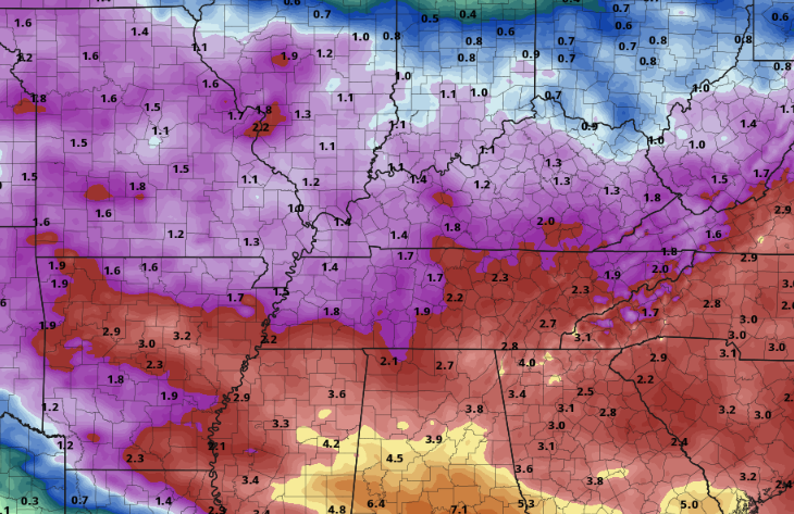
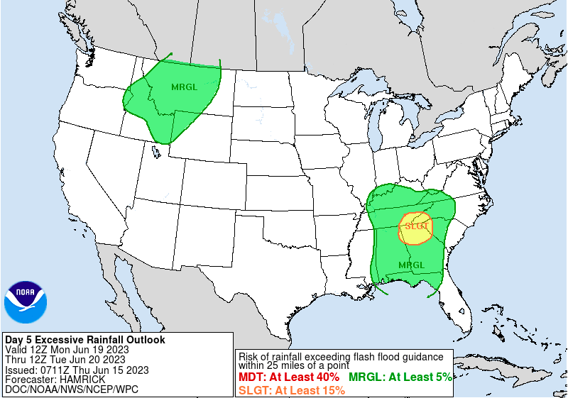
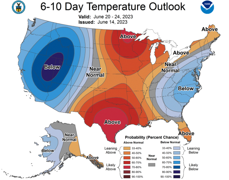
We'll start off with what's planned today through Saturday: Partly cloudy skies will prevail today and Friday, where hit and miss (isolated to widely scattered) showers and storms are forecast. These will mainly be during the warmer hours of the day. By Saturday, high pressure fills in, giving us a brief pause from precipitation chances (take advantage for the start of the weekend!) Thereafter, things take a turn. A slow moving approaching low pressure system will bring shower and thunderstorm chances starting Sunday evening and lasting through at least the first half of the work week. Guidance sets up what we call a "blocking pattern." This means the low will get blocked off, essentially stalling out across the Appalachians. As it does so, repeated rounds of showers are possible and could cause issues with water basins and flash flooding concerns as a whole. As of right now, there is uncertainty in the strength and residence time of the system, but check out rainfall totals through Tuesday evening. Keep in mind, changes are likely as better data comes in, but 2-3+" look to be on the horizon if trends hold. Additionally, guidance does not account for smaller scale details, which will become very key in flash flood potential. For now, know Sunday into next week will be active and something you should check back in/monitor. It is not very often the Weather Prediction Center throws out a Day 5 slight flash flooding risk, but that's exactly what they did today. Again with the mentioned concerns above, river flooding and/or flash flooding are in the realm of possibilities if things materialize as guidance suggests. Longer term, late next week, a cooler pattern takes hold. This makes sense as cloud cover and showers will limit heating during the day. Even further out (not depicted) a similar "cooler than normal" trend seems possible- as suggested by the Climate Prediction Center. Be sure to check back in tomorrow and this weekend, as we will have more details on rainfall Sunday into next week. As of now, things look increasingly likely several rounds of showers and storms are in the forecast during this timeframe and some hydro (and possibly some severe weather) related issues could arise. Pre-recorded for 5pm weather broadcast
0 Comments
Leave a Reply. |
Your trusted source for everything weather in East Tennessee.
Social Media
|


