|
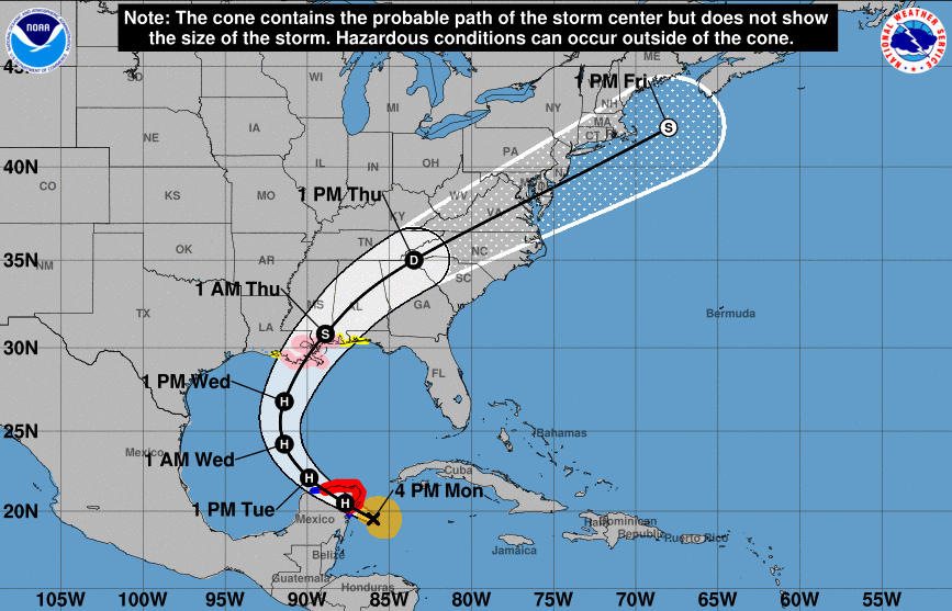
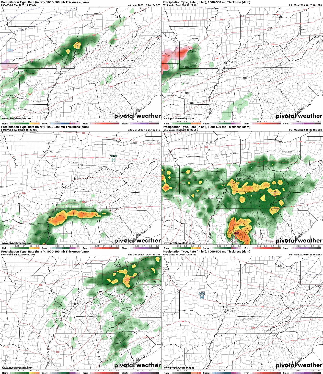
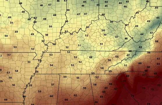
Good morning! We are seeing some patchy fog in spots this morning with temperatures in those mid to upper 50's. Things will stay pretty similar to yesterday with partly to broken skies and high's in the lower 70's. The big story, of course, is now hurricane Zeta. Model guidance continues to try and solve this systems path given the current weather features we have across the US. With this current model (below), two independent systems will work through. One, a cut-off low currently in the Plains and two, remnants of Zeta. The second option is for these two systems to essentially morph together to our west. For option 1.... In this case, heavy rainfall and the potential for flash flooding will be present late Wednesday and throughout Thursday. Model guidance has rainfall totals in the 2-5 inch mark depending on where you are. For option 2.... A westward track will leave significantly less rainfall across the eastern half of the state with rainfall totals in the 0.5 to 1.5 inch range. Given the uncertainty in tracks as of late last night/early this morning, I anticipate a more eastward track (similar to the NHC). This leads me to believe higher rainfall totals are likely across the area the second half of Wednesday and throughout Thursday. Check our daily video forecast below for more details. Regardless of the track, much cooler air will build in behind this system for Friday. A 15+ degree swing in temperatures can be expected with high's Friday lucky to top 60 degrees. This cool bed of air will stick around all weekend as well with high's in the lower 60's for Saturday and Sunday. Once Zeta gets closer to land, we will have a track better pinpointed out. For now, anticipate a more eastward track similar to the model above as well as the official National Hurricane Center track at the top of the post. As you can tell, there is still many things that need to be paved out, so check back in for more details and stay posted with us on social media.
2 Comments
11/1/2020 09:14:51
hello there and thank you for your information
Reply
11/1/2020 09:16:38
I'd like to thank you for the efforts you've put in writing this site.
Reply
Leave a Reply. |
Your trusted source for everything weather in East Tennessee.
Social Media
|


