|
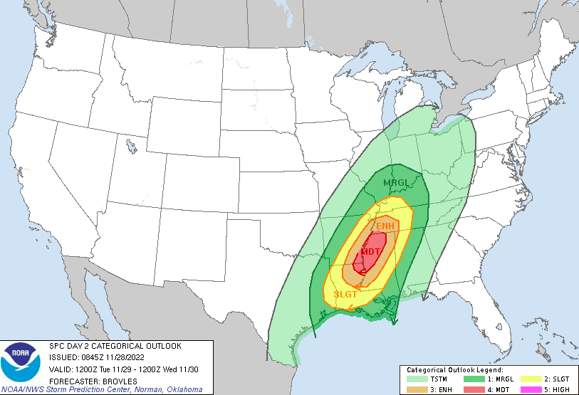
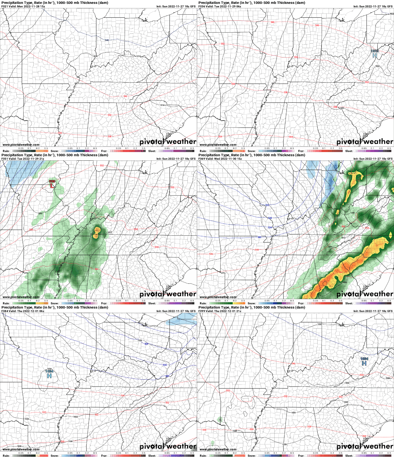
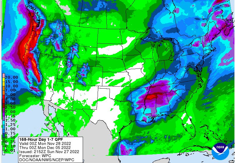
I hope you are having a good start to the new work week! An active stretch is in the works, with showers and storms in the forecast. Discussing today first, cloud cover will continue thinning out through the morning, where partly cloudy skies are common this afternoon. Highs will be a little cooler today, but still mild, in the mid to upper 50s. For tomorrow, just the opposite. Partly cloudy to begin the day, then increasing cloud cover through the remainder of the day. Showers arrive late evening and overnight through Wednesday morning. The reason for the activity is because a strong cold front will be working across the area. Plenty of forcing, moisture, and lift will create a favorable environment for severe storms. Looking at the SPC outlook for Tuesday to Wednesday morning, a Moderate (4/5) risk is in place across the Lower Mississippi. Large and long lived tornadoes will be possible in these areas. Fortunately for us, these storms will weaken eastward into the night. That said, a few strong to severe storms will remain possible primarily across the Plateau and southern East TN valley. The main threat will be strong to damaging wind gusts overnight Tuesday and into early Wednesday morning. Looking at the progression of this system, it will "initiate" across the Lower Mississippi Valley tomorrow afternoon, working eastward through the evening and into the overnight. Again these storms are expected to weaken with the loss of daytime heat and energy, but that does not mean all of them will. If skies stay a bit clearer during the latter half of the day, we could see some reason for stronger storms to linger into our neck of the woods tomorrow night. Some of the higher resolution guidance depicts the southern valley could be a concern early into Wednesday morning. We will continue to keep an eye on trends and the environment moving forward, but do keep in mind a few strong to marginally severe storms will be possible overnight tomorrow and into Wednesday morning. With thunderstorms in the mix, rainfall amounts will vary. That said, a general forecast of 1 to 2 inches can be expected through this week, where locally higher amounts are possible. Keep in mind another shot as some rainfall finds us this upcoming weekend as well. Following the cold front, much cooler air will arrive. Highs will be in the mid to upper 40s Thursday, before warming back into the 50s on Friday. Another chance for isolated to scattered showers then finds us into the weekend. Pre-recorded for 5pm weather broadcast
0 Comments
Leave a Reply. |
Your trusted source for everything weather in East Tennessee.
Social Media
|


