|
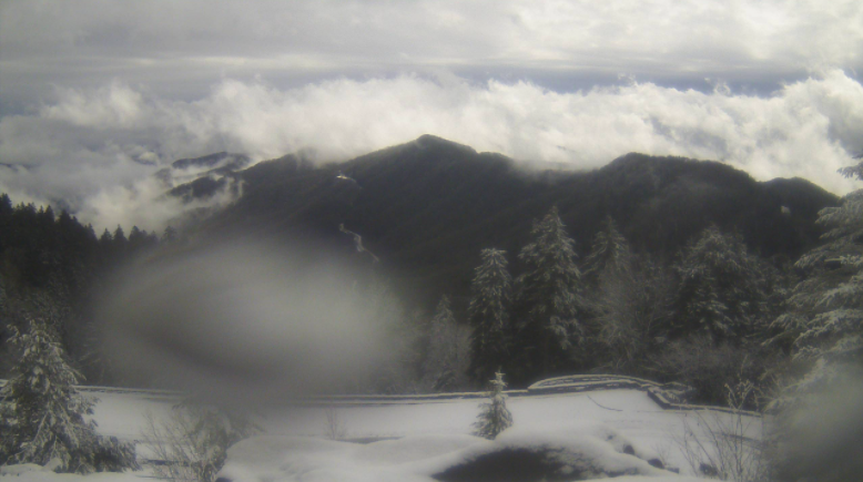
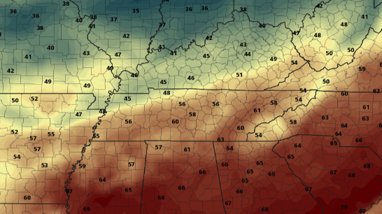
Good Monday afternoon to you! Rain worked out late this morning and the clearing out process has begun. Though there was no threat for winter weather last night/ this morning, very different conditions were felt at 5,000 feet. This gorgeous view comes courtesy of the Newfound Gap camera in the Smokies. Near 2 inches of snow has fallen as of noon. Looking ahead, we can enjoy some much needed sunshine and warm air. Temperatures will generally trend above average much of this week with most locations likely to see 60's Wednesday afternoon. Knoxville's average for this time of the year are the low 50's, so we'll take it compared to the 20's, 30's, and 40's we averaged just 7 days ago. I will note a chance for showers returning Thursday through the weekend as little disturbances work through the region. I mentioned Wednesday being our target day for warm air, and as you can see below, temperatures will range from the upper 50's to mid 60's. Some locations to our south could even flirt with 70 by mid-day Wednesday. We may not be entirely out of the woods yet for Winter but the pattern does look promising for a warmer next few weeks, at least for now. With our Almanac quickly on the way, we welcome you to be part of the addition with a sponsorship. More information can be found at SecretCityWeather.com/sponsors Pre-recorded for 5pm show
0 Comments
Leave a Reply. |
Your trusted source for everything weather in East Tennessee.
Social Media
|


