|
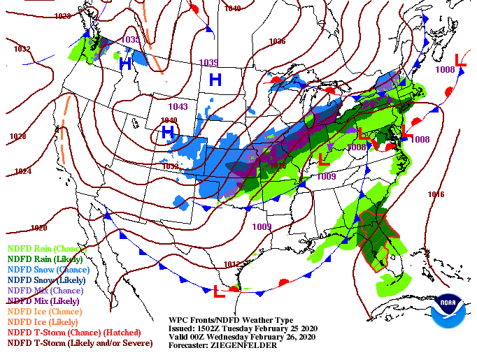
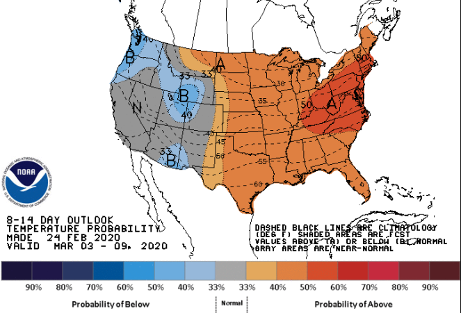
I hope you are enjoying your Tuesday so far! A very Spring-like day is ahead with temperatures into the lower 60's and broken cloud cover. Working ahead, showers are expected to arrive by the mid-morning hours tomorrow and continue into the afternoon. On the back-side of this system a cold front will provide much cooler air to end the work week. Future radar shows showers moving in by the mid-morning hours Wednesday. As we get into the afternoon, a cold front will work through decreasing temperatures. This model has the transition to snow taking place a bit earlier into the day than what I am thinking. Temperatures will remain above freezing into the evening hours (here in the valley) keeping things all rain. Once we get into the overnight hours, a few snow showers/flurries are possible here in the valley, but no impacts or accumulation is expected. As for the higher elevations, the Foothills and Plateau, minor accumulations and little impacts are expected Thursday morning. Looking ahead into early March, the CPC (Climate Prediction Center) has a trend in warmer temperatures. This graphic is for the first week of March with a 50% chance or higher of above average temperatures. For the time being though, keep the winter coats handy as high's in the lower 40's will stick around Thursday and into the weekend. Enjoy the Spring-like feel we have today because colder air is once again on the way. Don't forget the umbrellas either as showers work in tomorrow followed by cold air, breezy conditions, and scattered snow showers.
0 Comments
Leave a Reply. |
Your trusted source for everything weather in East Tennessee.
Social Media
|


