|
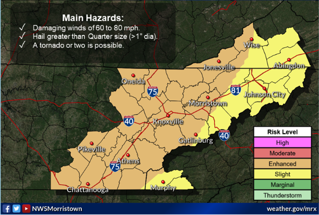
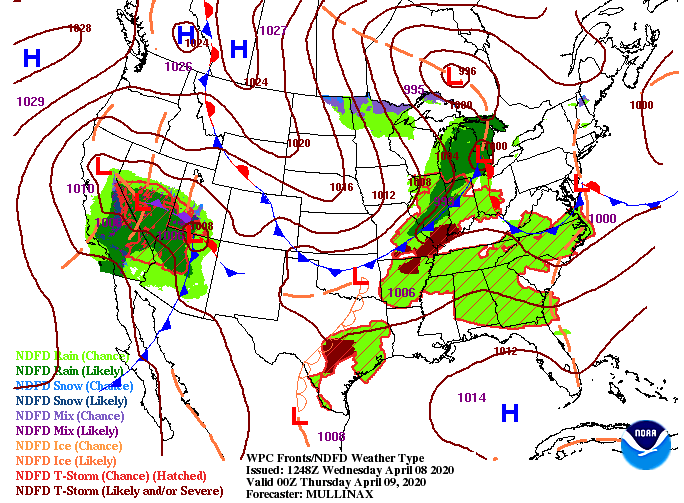
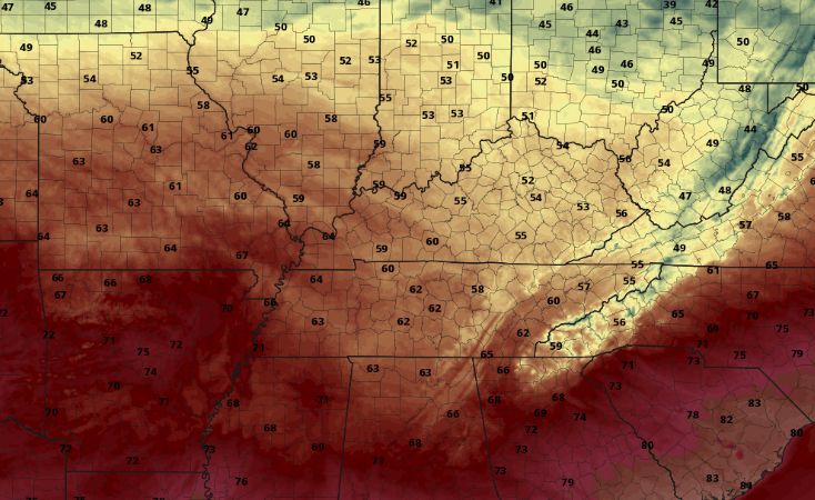
All eyes are set on tonight as much of the region is under an 'enhanced' risk for severe storms. As indicated by the NWS below, the primary threats will be damaging winds (60-80 mph), large hail, and frequent cloud to ground lightning. Secondary threats include isolated tornadoes. The low pressure system in the Great Lakes region is parent to the cold front extended to its south. This is what we will be eyeing as we work overnight. Storms will begin kicking off after sunset to our north and west (ahead of the cold front) and work in a southeasterly direction. As you can see from model guidance, little activity is expected this afternoon. For the most part, we will stay dry with a mix of sunshine and a few clouds throughout the area. As we work into the evening hours, storms will begin firing up in western Kentucky and working toward the east. With the given data, I believe the biggest threat will be for those in western Kentucky and Western Tennessee. As this bowing structure moves east it will gradually die down overnight. This isn't to say we won't see severe activity through the area but instead to say things look a little better at home than to our west. The timing of this line falls between 2am and 6am; unfortunately when many are asleep. I will emphasize having a way to receive alerts and taking the proper precautions. As we saw with our most recent storms (occurring overnight as well) straight line winds are capable of producing the equivalent of EF-1 tornado damage. As for Thursday, a trailing cold front will quickly clear things out providing sunshine and cooler temperatures the next couple of days. As we jump ahead, cooler air will work in through Thursday leaving high's only in the lower 60's. Again into Friday, high's will be in the mid to upper 50's with warmer temperatures expected into the weekend. It is very important you have a way of receiving alerts (watches & warnings) overnight. As always, we'll be up late to keep you updated with the latest in regards to this system. Stay safe and stay weather aware!
0 Comments
Leave a Reply. |
Your trusted source for everything weather in East Tennessee.
Social Media
|


