|
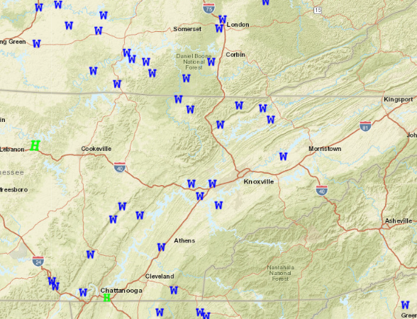
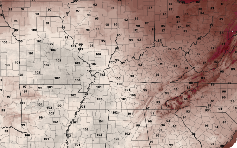
Good morning! After rounds of showers and storms yesterday and again early this morning, things are starting out calm. We saw our first round of activity early yesterday afternoon with a decaying/weakening meso-convective system. These are fine scale driven systems that are challenging to depict days ahead of time. After that moved through, a line of storms associated with a cold front found its way in late last night/ early this morning. The combination of the two left several power outages and wind damage as depicted below. If you have damage you would like to report, send us an email, comment, or submit to us your location, what happened, time (if known), and a picture if possible as well. These are helpful to the NWS in verifying warnings as well as keeping track for local officials/aid. Heading through the week, it'll be a pleasant one. Cloud cover thins out this morning, leaving sunny skies the remainder of today. Similar conditions are set for Tuesday as well, with highs in the mid 80s and sunny. Towards Wednesday, we will take a turn toward a warming trend. High pressure will break east, floating into the Mid Atlantic. As it does so, "return flow" will pull in moisture and warmer temperatures from our south. As a result, it'll be warmer, more humid, and isolated to scattered pop up afternoon showers/storms will be possible Thursday and onward. How warm will things get? Likely the warmest we have seen so far this year. Looking below at guidance, most valley locations will more than likely see low 90s by Friday afternoon, while the higher elevations also seasonably warm in the upper 80s to around 90. This is a good time to keep your heat safety in mind! Again, please share any storm damage you might have from yesterday's storms and we will get those passed onto the proper location. These also help us know what is going on and where. Other than that, enjoy a beautiful Monday and first half of the week, before much warmer and stickier air finds us late week into the weekend. Pre-recorded for 5pm weather broadcast
0 Comments
Leave a Reply. |
Your trusted source for everything weather in East Tennessee.
Social Media
|


