|
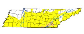
Another pleasant day to end your work week with highs expected to be in the mid 80's. For this weekend we will remain pretty dry and with this, these dry days have started taking a toll. If you recall, on Monday we presented this same graphic showing only isolated areas (NE, Plateau, and Chattanooga) under abnormally dry conditions, but now, the entire state is under abnormally dry. This is an issue we need to be eyeing in the next several days as it will likely only get worst with little rainfall expected in the forecast.
Taking a look at the surface map right now, we will remain dry into the weekend with a high pressure system sitting on the east coast. Temperatures may feel a little cooler as dew points are expected to stay low. This will make temperatures feel closer to their true value versus the muggy and sticky conditions we have felt much of this month. As we get into the later half of the weekend, we will have a low slide to our north. With this will be a cold front that could provide the chance for some light showers Monday afternoon. We will also cool down a bit with high's in the lower 80's. 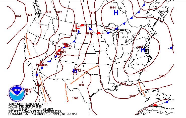 Looking at our model guidance as it rolls through, we do see by Monday afternoon a line of showers slide in, but with the dry air in place these will quickly break apart giving only isolated to scattered shower potential. As I said, though, very limited shower potential in the next week or so, which will likely contribute more to the overall drought we are seeing. 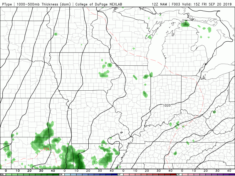 Thats all we have for your Friday but go out and enjoy a "cooler" and drier weekend. We would love for you to share your pictures with us if you are hiking, on the lake, viewing the sunsets etc. You can send them to us at [email protected] or tag us on our social media @SecretCityWx (Facebook & Twitter) where we will give you full credit. Have a good weekend!
0 Comments
Leave a Reply. |