|
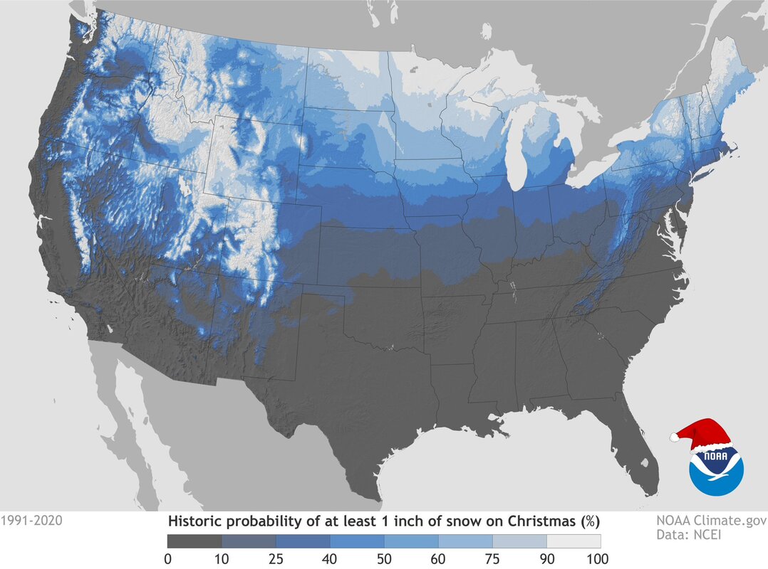
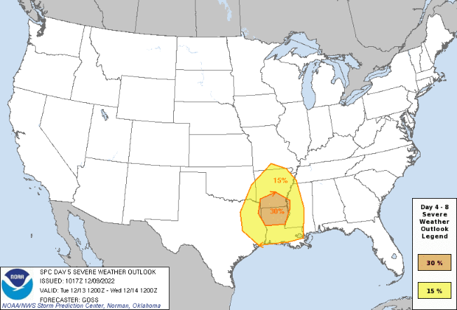
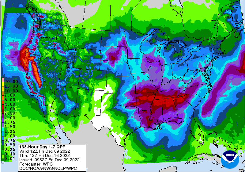
Alright my snow lovers, not great news as it relates to statistical averages. This historical probability map comes from NCEI, calculating the chance for a white Christmas based on 30-year averages (1991-2020). As you can see below, chances are less than 10% for most of the area. With that said, there is hope! Longer term outlooks indicate a pattern swing to cooler air and this is backed by CPC outlooks as well. As we will discuss here shortly a potent system will bring this change later this upcoming week. For those in the higher elevations, there is a much better chance. For instance, Mt. Leconte has a greater than 40% chance for a white Christmas. As touched on, a change is coming this next week. A strong low pressure system is expected to push into the Lower Mississippi Valley, bringing strong to severe storms which could carry its way into our next of the woods. The good news is this system will weaken eastward, minimizing our chances of severe weather but not completely ruling it out. Strong to damaging wind gusts appear to be the primary threats for now, but can't rule out all hazard types. Additionally, given the rounds of soaking rains we have picked up through this week, flash flooding could be a concern. Heavy rainfall rates look likely at times, so this will also be something we closely monitor ahead. Looking at the 7 day rainfall outlook, more rainfall is on the way. In fact, we could see upwards of 3+ inches over the next week, again bringing the opportunity for flooding/flash flooding given the already soaked grounds. The timing of this strong system will be late Tuesday and through Wednesday, but duration, exact timing, and strength (across East Tennessee) are still uncertain. We will have more details as our confidence surrounding this disturbance grows. As far as expectations the next couple of days, generally improving conditions can be expected. Any lingering showers will fade tonight, leaving us mostly cloudy through the first half of the day Saturday. One last system then brings rainfall later Saturday and into early Sunday, before drier air returns Sunday afternoon and through at least the first half of the day Tuesday. Yes, we will even see some sunshine early next week. Temperatures through this time will generally be in the mid to upper 50s for highs and lows in the upper 30s to mid 40s. Pre-recorded for 5pm weather broadcast
0 Comments
Leave a Reply. |
Your trusted source for everything weather in East Tennessee.
Social Media
|


