|
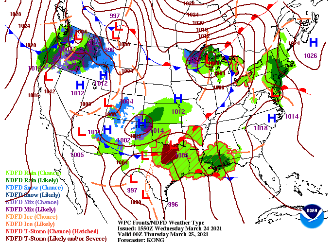
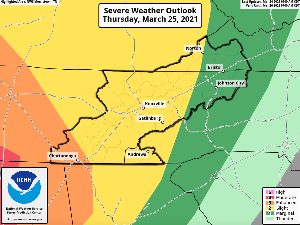
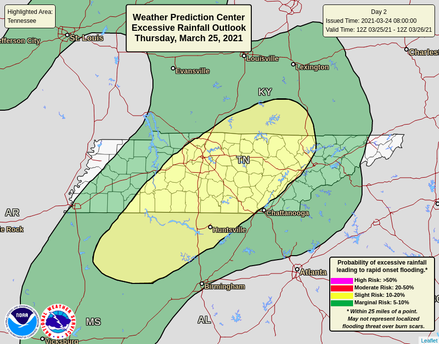
A low is currently developing and enhancing along northern Texas and Oklahoma this afternoon. It is expected to work north and eastward, bringing strong and severe storms to parts of Alabama, Mississippi, and Tennessee tomorrow. The latest SPC Day 2 outlook encompasses Chattanooga in the Enhanced (3/5) risk, while the remainder of East Tennessee sits under the Slight (2/5) risk. Strong storms will bring the opportunity of damaging winds (15% chance) and severe hail (1-inch or large at a 5% chance). We again have nightfall on our side to help, as storms will slowly weaken eastward towards the end of the day. Along with severe weather, flash flooding also remains a hazard. The western half of East Tennessee sits under a slight (10-20% chance) for flash flooding through the day tomorrow. Rainfall accumulations will generally range between 1 and 3 inches but locally higher amounts are possible under training heavy storms (mainly across Middle TN). Looking at future radar, widespread moderate showers will start the day tomorrow. By the late morning to early afternoon, they will become more scattered. This will be the time period that will really judge and set up the later strong to severe "stuff". A few ingredients to look for that could enhance the severe odds include high dew points, sunshine, and limited storms through the early afternoon. Timing for the line ahead of the cold front comes between 8pm and 2am. There is still uncertainty on how quick the low & front move through the day tomorrow. Overall, be on alert through the afternoon, evening, and overnight hours. The biggest threats are damaging winds, hail, lightning, but isolated tornadoes remain possible. Be sure to have all your severe weather plans ready. These include a save place to hide if a tornado warning were to be issued, spare batteries, food, water, flashlights if power were to go out, and a way to receive watches and warnings if they were to be issued. The worst weather will be under the red "bullseye" but severe storms can't be ruled out through the later half of the day tomorrow for our neck of the woods. Pre-recorded for 5pm show
0 Comments
Leave a Reply. |
Your trusted source for everything weather in East Tennessee.
Social Media
|


