|
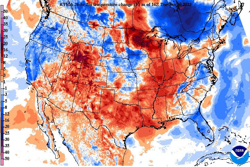
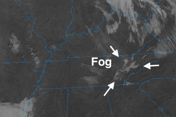
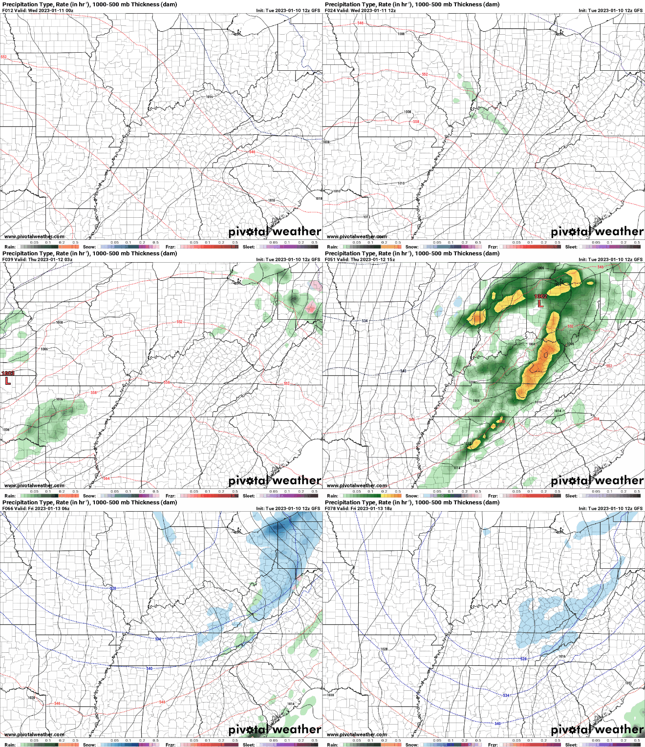
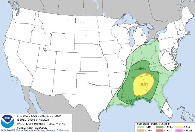
Good afternoon! Warmer temperatures have begun working their way back in across the region, but check out this neat phenomena. If you look closely across the East Tennessee Valley, you can see blue indicating temperatures cooler than yesterday and obviously cooler than the surrounding areas....why is that? Fog! It hampered us in early and has been slow to burn off late in the morning. Fortunately, we are seeing the last of it dissolve now, where warmer temps find the area. Highs today should top out in the low 50s for most. Towards mid week, an area of low pressure will be knocking on our door, where a cold front will slide through on Thursday. Clouds will increase late tonight and through Wednesday, leading to isolated shower chances Wednesday night into early Thursday. Widespread showers and a few storms are then expected during the day Thursday, where a few storms could be strong to severe (further discussion below). As the front sweeps through late in the day to early Friday, a change over to some snow is possible. "Up-slope" flow, as we like to call it, will allow for lingering isolated snow showers/flurries the later part of the day as well. Accumulation-wise we look to keep things in tact from yesterday, where the likely locations are across the higher terrain of the Smokies, and light accumulations aren't ruled out across the Plateau. Elsewhere a light coating to nothing is more than likely as of now. We will have more details surrounding the entire system (both severe, rainfall, and wintry precipitation) tomorrow. Here is the outlook for Thursday, showing a slight across the far southern valley and SE, while a Marginal covers much of the rest of the area. Though we are far out for some of the higher resolution data, some indicate there may be a shift further north, so we will keep an eye on if the SPC changes this up some in future outlook releases. Nonetheless, there's the potential for isolated severe weather, so be weather aware into Thursday. The main threat will be damaging wind gusts but isolated areas of spin up can't be ruled out. We will remain dry and above average today and much of tomorrow, before showers and a few storms arrive Thursday. Be sure to check back in tomorrow for the latest forecast, as we will have a better idea on timing, amounts, and potential impacts. Have a good one! Pre-recorded for 5pm weather broadcast
0 Comments
Leave a Reply. |
Your trusted source for everything weather in East Tennessee.
Social Media
|


