|
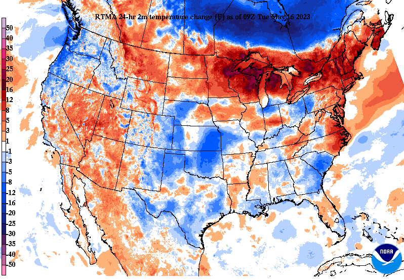
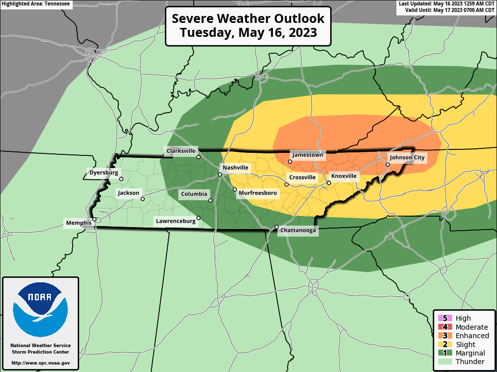
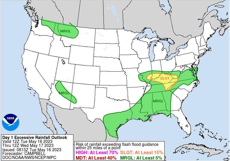
The latest 24-hour temperature map depicts near neutral to slightly warmer temperatures across the northeast and into KY. This is important, as it depicts a building warm front and area of focus for strong to severe storms this afternoon and evening. In summary of the day, mostly cloudy skies are expected this morning (though an isolated shower is possible), with increasing shower/storm chances into this afternoon. The Storm Prediction Center has upgraded a section of the area to an enhanced (3/5) for locations generally bordering Kentucky. This is along and near the warm boundary mentioned, giving way to all severe weather hazards. The primary threat will be damaging wind gusts, but large hail, and a few tornadoes are also possible. Be weather aware this afternoon/evening and have a way to receive alerts. The timing for severe storm potential will be between 2-9 pm today. In addition to the severe threat, there is also a hydro threat. Looking from WPC, a slight risk encompasses the area. With pockets of heavy rains the past few days and a series of scattered storms expected today, flash flooding will be possible. This is particularly so for any location that sees repeated activity. These storms will be heavy rainmakers, so take action now if in flood prone/low lying locations. The biggest concern will come this afternoon and evening with storms and flash flooding. Have multiple ways to receive warnings and have an action plan established now. Generally drier conditions follow Wed-Fri, with very low end shower chances during this stretch. A late week/weekend cold front then brings the return of showers or storms Saturday into early Sunday. Check out our video forecast below for more. Pre-recorded for 5pm weather broadcast
0 Comments
Leave a Reply. |
Your trusted source for everything weather in East Tennessee.
Social Media
|


