|
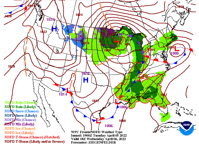
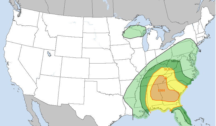
A cold front will take aim at the area today, and will be the focus for a thin line of isolated strong to severe storms. The SPC has upgraded the enhanced area to include most of East Tennessee, so know what to do if warnings are issued this afternoon. As far as timing, the threat timeframe will be between 4-8pm. Following this system, we'll dry out briefly Thursday before rain and even some mix returns Friday and Saturday. Cooler temperatures will also follow with highs tomorrow in the 60s, with low 50s by Saturday. The latest SPC outlook can be seen below, with categorical 3/5 in place. Damaging winds gusts are the main threat, but tornadoes and instances of large hail are possible too. The highest threat will be across the far southeast, but all will have potential. Have a way to receive watches/warnings and know your secure location if thunderstorm and/or tornado warnings are issues this afternoon/evening. Stay safe, give us a follow as we'll be tracking this this afternoon, and send reports if you are safe to do so. Once again timing will primarily come between that 4-8pm window.
0 Comments
Leave a Reply. |
Your trusted source for everything weather in East Tennessee.
Social Media
|


