|
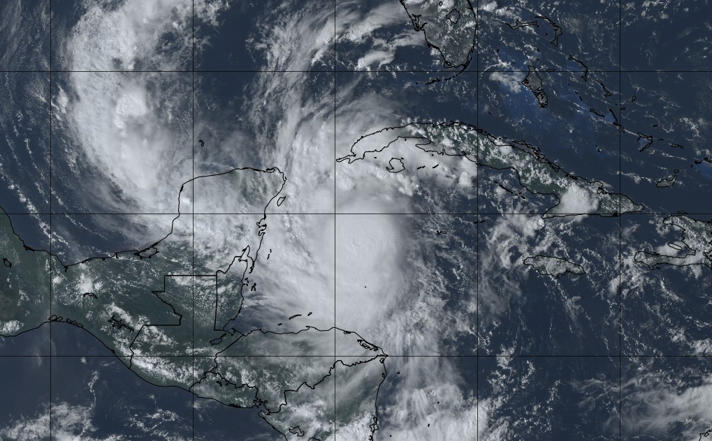
The latest satellite imagery of Hurricane Delta shows landfall to soon be made in Mexico. As of last night, this hurricane was a category 4 storm. Expectations are for Delta to weaken as it works through the eastern tip of Mexico and back into Gulf waters. From there, uncertainty lies with strength, landfall timing, and path. For now, we continue to enjoy the sunshine and above average temperatures. High's today will top out in the upper 70's to low 80's under sunny skies. Similar conditions are in store tomorrow with high's warming to the mid 80's for some spots. By late Friday, Delta will make landfall bringing cloud cover and isolated shower chances to the area. As of the latest, the heart of Delta stays westward, bringing the heaviest rainfall to western and central TN. Early guidance is suggesting anywhere between the 1 and 2 inch mark here in east Tennessee, but tropical systems are very challenging to forecast for. Given the length of time out and uncertainty in intensity and path, better details will be paved out in the days to come. For now, enjoy the warm and sunny conditions but do anticipate for rainfall through the weekend. Tune in as we progress through the week; more details will be provided as to path, intensity, and duration. Sunny skies and above average temperatures continue for Thursday before tropical moisture and cloud cover find their way into Tennessee by late work week and weekend.
0 Comments
Leave a Reply. |
Your trusted source for everything weather in East Tennessee.
Social Media
|


