|
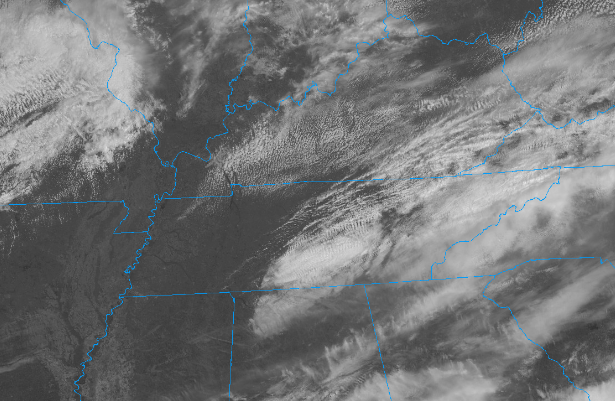
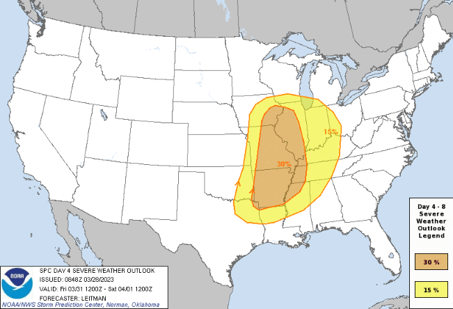
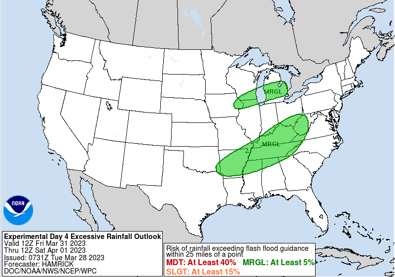
Other than a few light showers to sprinkles today, most have stayed dry but cloudy. Temperatures are cooler as a result, in the 50s now and warming to the low 60s by days end. The good news is clearer skies are in sight. Looking at the latest (12:20 pm) satellite image below, sunny skies prevail across West and portions of Middle Tennessee. This cloud shield will continue march east, allowing for clearing skies overnight into Wednesday. High pressure will then remain in control through Thursday, before a strong area of low pressure glides nearby and brings a renewed threat for showers and storms Friday into Saturday. The SPC has highlighted its thoughts on the severe risk, with a slight chance (and greater) staying just west. That said, we are very likely to be under at least a Marginal risk, with a slight chance seeming favorable for at least the plateau and possibly southern valley. Time will tell, as there remains some uncertainty in the exact timing in larger scale models. Start preparing now if there could be a severe storm or two and what you would do. The WPC has also placed the area under a Marginal flash flooding risk, again for those strong storms and heavy rainfall makers. Friday night into Saturday morning will be the timing for the bulk of activity, good news as far as the lesser severe risk timeframe. Nonetheless, be weather aware Friday night and stay tuned for further updates. That will do it, temperatures tomorrow will fall similar as today with highs in the lower 60s. Thankfully, a warming trend ensues, with highs climbing back into the low and mid 70s by Friday. That said, breezy conditions should be expected both Friday and Saturday with the tightening pressure gradients across the area. Pre-recorded for 5pm weather broadcast
0 Comments
Leave a Reply. |
Your trusted source for everything weather in East Tennessee.
Social Media
|


