|
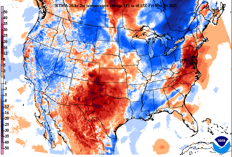
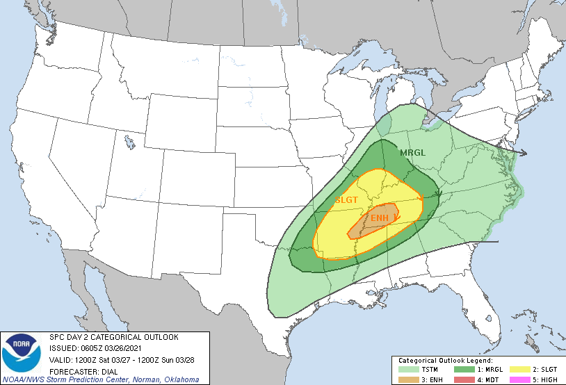
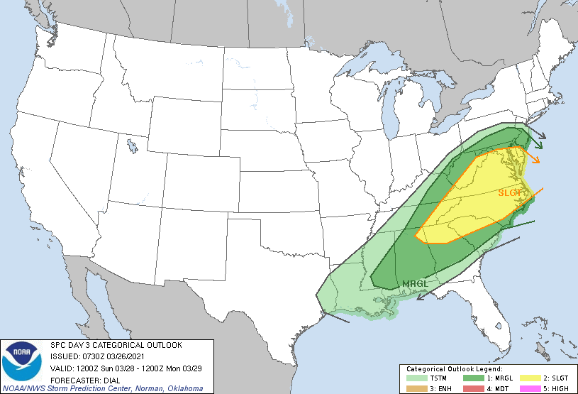
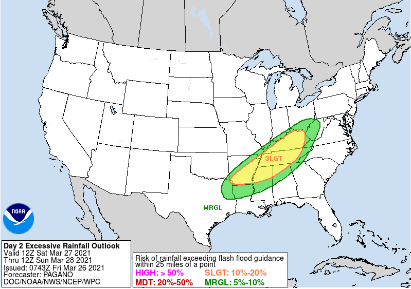
A much needed pleasant end to the work week is upon us with plentiful sunshine and mild temperatures. Comparing the current temps to this time yesterday, the western 2/3's of the state are a bit cooler with the passage of a cold front. Pushing into the weekend, another round of strong to severe storms is possible. The timing falls Saturday evening/night and into early Sunday. The Day 2 SPC outlook has an enhanced notch for Western TN with the Day 3 putting in East TN. This is because of the day transition from the system arriving Saturday night into Sunday. Regardless, the biggest threat will be straight line/damaging winds. With the heavy rainfall picked up last night and again expected this weekend, downed trees and power lines will be something to look out for. Hail and isolated, short-lived, tornadoes can't be entirely ruled out either. Flash flooding will be another hazard to look for. With several inches of rainfall picked up yesterday, another round could allow for water levels to rise quickly. A slight risk encompasses much of the state Saturday into Sunday. Model guidance breaks down with dry conditions through Saturday morning before scattered showers arrive late morning to early afternoon. This will be followed with a line of storms working west to east. Repeating, the greatest threat will be damaging winds and flash flooding. Showers continue into the first half of Sunday before we dry back out Sunday night and Monday. Isolated to scattered daytime showers will then follow towards mid-week. Temperatures, overall, will trend at to slightly above average. I hope everyone has a great weekend, stay safe and weather aware! We'll provide updates via Twitter & Facebook through the weekend. Pre-recorded for 5pm show
0 Comments
Leave a Reply. |
Your trusted source for everything weather in East Tennessee.
Social Media
|


