|
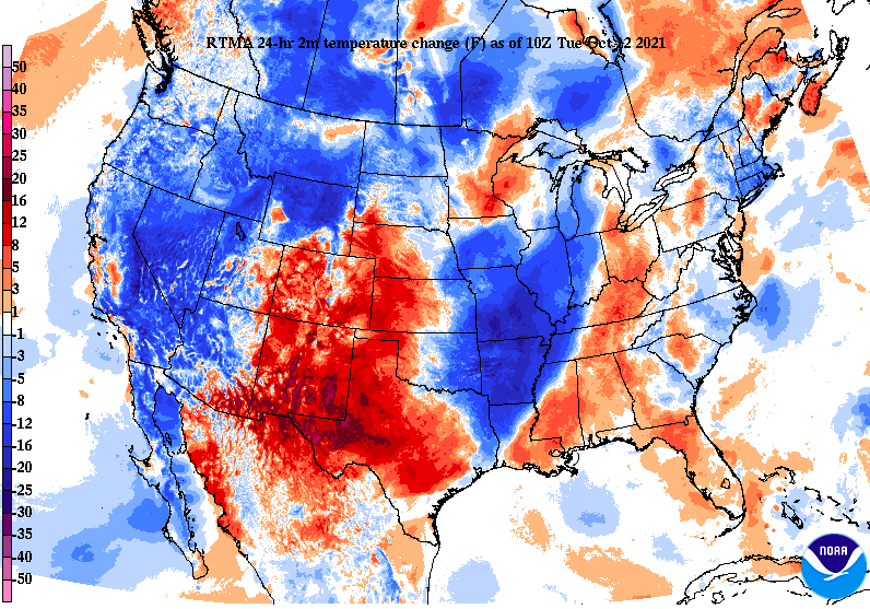
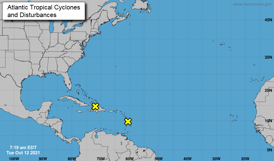
Good afternoon! A bit more cloud cover is across the area this afternoon as a dying cold front works across the area. Looking at the past 24-hours, you can clearly define where this front is located, with much cooler air overnight and into the morning just to our west. The Atlantic has been on the quiet side as of late, but a few disturbances are once again popping up in the Caribbean. Development looks limited over the next 48 hours, but will be something to watch through this week. Overall, rain chances will be limited through the work week. Our best shot doesn’t arrive until Friday afternoon, with an approaching (& stronger) cold front. With winds out of the south pumping in moisture, a few isolated showers are possible during the day. Overnight and into Saturday, much better forcing and moisture will be in place, allowing for widespread showers through the first half of the weekend. Rainfall amounts will vary, but generally expect between 0.25" and 0.75". High pressure will then fill in behind, bringing a cool but dry Fall-feel early next week. In summary, very warm temperatures will again be in the works this week, as high pressure and upper level ridging reside across the Southeast. A weak and washing out cold front will progress through the area today, but rainfall chances look limited to the Plateau and west. Temperatures will stay pretty much idle, though a degree or two cooler will be possible this afternoon. Into the mid week, and notably Thursday, a passing warm front (in addition to high pressure) will crank highs into the mid 80s (yeah & we are in mid October..). For reference, the average high is 73 and the record high for Thursday the 14th is 87 (set in 1881). Though I am not expecting we break this long standing record, we will likely still come close. Good news then follows as a stout low and cold front press east out of the Central Plains, bringing a much needed air-mass change. Widespread showers will pass Friday and into the first half of the weekend, with much cooler (near to slightly below average) temperatures find us through early next week. Pre-recorded for 5pm show
0 Comments
Leave a Reply. |
Your trusted source for everything weather in East Tennessee.
Social Media
|


