|
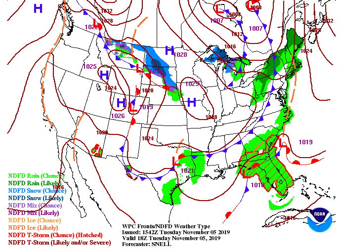
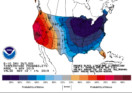
Happy Tuesday all! It has been a pleasant start to the work week with high's in the 60's but unfortunately, changes are coming. Model guidance shows the possibility of a sprinkle or two this afternoon (in the higher elevations) but for the valley, expect to stay dry with clearing skies by this afternoon. Working into Wednesday, much of the same with mostly sunny skies and high's back in the 60's. Toward the end of the GIF below, you can see showers start to work in late tomorrow night and into early Thursday (from west to east). This is all apart of our next system that will arrive to close out the work week, bringing much cooler temperatures Friday and the weekend. The broken cloud we had to start the day is associated with a weak front that has pushed east. The high following will keep things dry and comfortable Wednesday (as model guidance suggested) before a system arrives Thursday. With this next system, expect rain totals between 0.5 inches and 1 inch throughout east TN. Following the showers, a strong cold front will push through. As this cold front moves in, parts of the smokies could see a brief transition to some frozen precipitation overnight Thursday. We will stay with all rain here in the valley but temperatures into the 40's are expected as high's Friday. Looking into next week, conditions do not look to improve (temperature-wise). With a 70%+ chance of below average temperatures, confidence is high we will stay well below the typical mean for this time of the year. Arctic air is expected to dip into much of the eastern half of the US bringing high's into the 30's for some and low's in the teens by mid-week next week. Be sure to check back in for the latest regarding this early season cold fluke we are anticipating next week. We could see some records being broken throughout the US this time next week. That will wrap up your Tuesday forecast! Share your great pictures on our social media by tagging us or emailing them to us. We had several great shots of the sunset last night sent in and we would love to post yours as well. Have a great day!
0 Comments
Leave a Reply. |
Your trusted source for everything weather in East Tennessee.
Social Media
|


