|
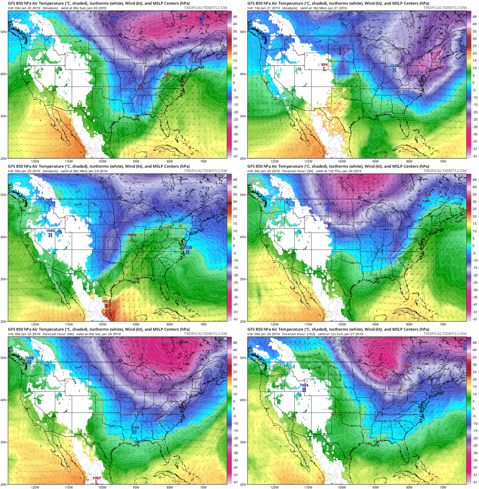
Happy hump day as they say! Most of East Tennessee is under a WIND ADVISORY. This means winds will be blowing anywhere between 15-30 mph with gusts of 45+ mph. Be careful if you are driving or plan to drive as winds can easily push around a moving car. If you have yet to leave the house for your days activities, remember to bring an umbrella with you as it will be a wet one today. Showers will move in and remain steady from around 2pm and on into the night. Amounts of an inch are more are likely with this system. Similarly to the last system this past weekend, very cold Arctic air will tail bringing cold temperatures in a quick time period. Do not rule out the possibility of some brief snow showers/flurries for east TN with the bulk of the northeastern portion and higher elevations receiving this type of precipitation. For the remainder of us in east Tennessee, expect cold temperatures for your Thursday with a high in the upper 30's. Friday looks to be even colder as the cold front passes completely through leaving behind highs in the low 30's. The sun will be trying to peak through the clouds Thursday with partly cloudy skies. Friday looks to be a similar story with partly cloudy skies. Now for the fun part for you winter lovers out there.....The cold will continue. The pattern for most of the eastern US as a whole seeing below average temperatures into the first week of February is HIGH. Over the next two weeks, expect what we have seen this week with cold temperatures a few warm up days and cold temperatures returning. With a ridging pattern sitting in the west, a deep trough over the eastern half of the US seems dominate for the next few weeks. To get a better understanding of what this means, refer to the image below. This refers to the jet stream in the atmosphere that controls a lot of the weather we receive. Ridging typically refers to a high pressure system with warmer and dryer conditions. Oppositely, a trough pattern (what the eastern US looks like and will continue for the next couple of weeks) is much cooler temperatures with periods of precipitation and more active weather. For the snow lovers out there this is a positive trend for the next couple of weeks. Early to mid next week could be the first chance of seeing a good snow in east Tennessee. I will up date you on the outlook and chances of this possibility later this week. For now, stay dry and bundle up as the rain will move in today and bring colder temps for the days to come.
0 Comments
Leave a Reply. |
Your trusted source for everything weather in East Tennessee.
Social Media
|


