|
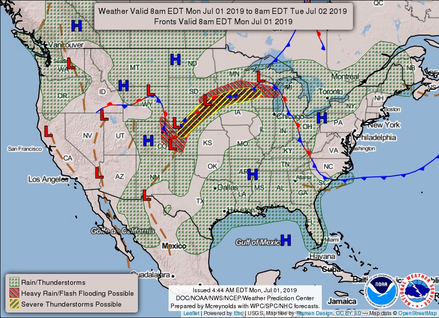
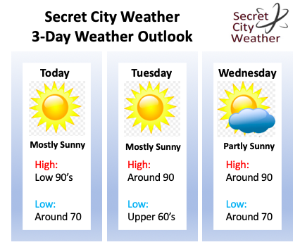
I hope many of you have stayed cool and hydrated through the weekend, as it has been a warm one. Unfortunately, the heat will not be letting up anytime soon. First looking at the forecasting map produced by the NWS, we see a dominating high pressure system in the southeast. This has stuck around for several days resulting in the clear skies and warm temperatures we have had. As I said, this will continue most of the week, as high's are expected to stay in the low 90's through Independence Day. Along with the warm temperatures, expect high humidity. This will make afternoon high's feel closer to the triple digit mark today and mid to upper 90's Tuesday. Afternoon pop up storms still remain something to be cautious of throughout the first part of the week. With a nice layer of moisture present and afternoon temperatures climbing into the 90's, pop up storms induced by topography are possible. Storms that do develop will generally stay outside of the valley in the higher elevations, but don't be alarmed if an isolated storm or two does pop up in the afternoon and early evening hours. The latest NAM model run indicates much of the same cloud (or lack of) conditions over the next few days. As anticipated, the high pressure system will keep most of the region high and dry, meaning mostly sunny skies. During the overnight hours we could see clouds develop as nocturnal temperatures near the dew point indices. Fog is possible in the early morning hours, so be cautious on your way to work. Toward the end of the work week, we could see some increased shower potential due to rounds of embedded shortwaves. This will allow for slightly cooler temperatures (in the upper 80's) by Friday and the weekend, but I will have a better idea on precipitation chances and temperatures in the coming days. Until then, stay cool and hydrated and I hope everyone has a great week! Below is your 3-day weather outlook across the region. As I said, hot with temperatures in the low 90's, feeling like the mid to upper 90's, and isolated pop up storms possible in the afternoon hours. For your full forecast, check out the "Weekly Forecast" tab at the top of our site.
0 Comments
Leave a Reply. |
Your trusted source for everything weather in East Tennessee.
Social Media
|


