|
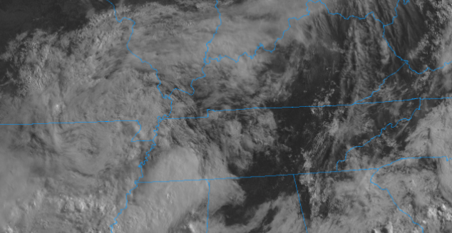
Cloud cover lingers this morning but for the most part, East Tennessee starts out rain free. As we work through the day, showers and a few thunderstorms will develop with afternoon heating and shortwave energy working across the area. Temperatures will be a bit warmer today given the rising heights, with highs topping out in the mid 80s for most valley locations. The pattern remains the same as Monday with conditions to follow to be similar too. Energy aloft combined with amble moisture and heat will provide opportunities for afternoon showers and thunderstorms to develop each day. Some areas could see localized heavy rainfall and gusty winds, otherwise showers should be relatively quick moving. It is worthy to note the WPC has a slight risk for flash flooding on Thursday as a low works eastward bringing moderate to heavy rains on top of already saturated soils. This will be something we'll closely watch over the next day or so. For now, keep the rain gear handy. Things will continue to be warm and muggy today with showers and thunderstorms again possible. Flash flooding could become an issue by Thursday, so use caution in low-lying, near water bodies, and in flood prone areas. Pre-recorded for 5pm show
0 Comments
Leave a Reply. |
Your trusted source for everything weather in East Tennessee.
Social Media
|


