|
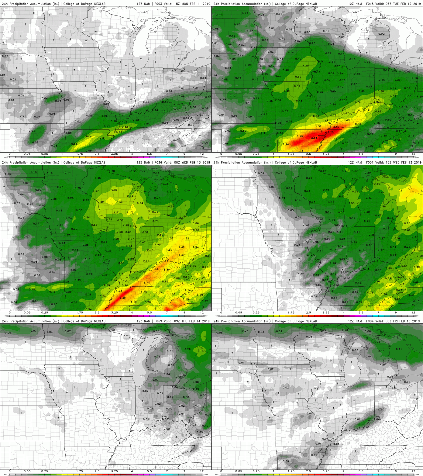
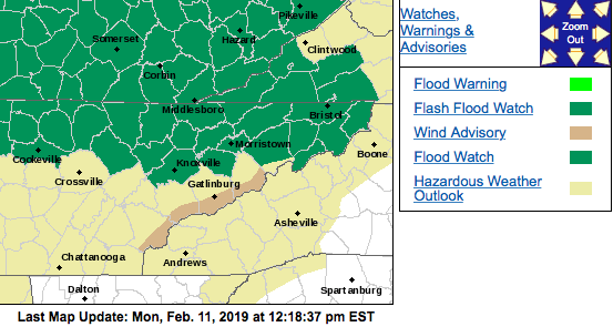
Grab those umbrellas and rain jackets as it will be a wet one for the early portion of this week. The northern half of east Tennessee is under a Flood Watch. The Flood Watch is in effect until Tuesday (1/12) at 7 pm. A low pressure system to our west is bringing a large amount of precipitation being fed from the southeastern Pacific. As the low progresses to the east this evening, it will bring the potential of some heavier periods of rain. Rain tomorrow morning and into the afternoon is likely to bring another 1"+ to most of east TN. According to the USA Climate Data, Knoxville and the surrounding cities typically receive around 4″ of precipitation for the month of February. This means, Tuesday alone could bring 1/4 of the monthly average amounts. Due to the active pattern of the subtropical jet and polar jet, we have received above average amounts of rainfall for the month of February. As you can see below, heavier rain is expected to arrive late tonight and continue into the first half of Tuesday.  24-Hour Precipitation Amounts (Source: COD Weather) Hold on for a couple more days and the rain will move out bringing back those sunny skies. Wednesday and Thursday is expected to be mostly sunny with high's in the low 50's and low 60's, respectively. For more detail on the high's, low's, and rain chances, refer to the "Weekly Forecast" tab located at the top right portion of the page.
2 Comments
12/26/2019 06:04:42
Sindhi Model School of Excellence is Best CBSE Affiliated School in Thiruverkadu Provides best education with Practical Methods & Other Extracurricular Activities to engage with young mind.
Reply
12/1/2021 06:59:28
Eumaxindia - Leading Daily Thanthi Advertising Agencies in Chennai – Publish Classified & Display (Obituary/Remembrance) Ads in Daily Thanthi Newspaper at affordable price.
Reply
Leave a Reply. |
Your trusted source for everything weather in East Tennessee.
Social Media
|

