|
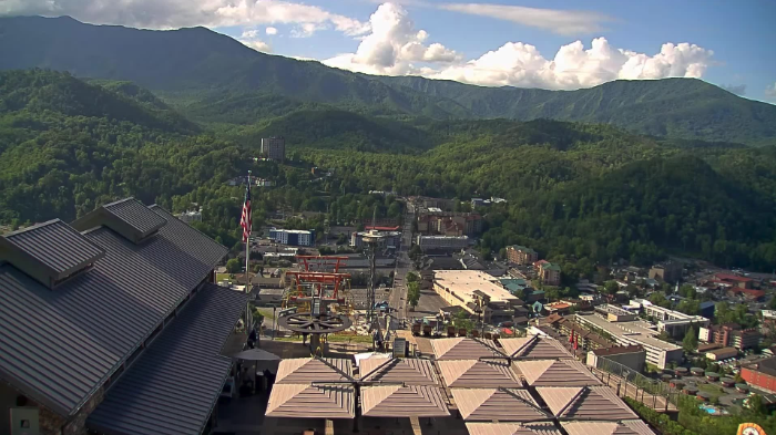
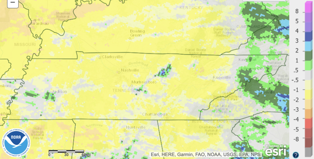
Check out the latest view over Gatlinburg (courtesy of Skylift Park). A gorgeous partly cloudy day, with temperatures right now ranging in the upper 60s to mid 70s. We will warm several more degrees before days end, peaking in the low to mid 80s. Even warmer air is set to build in for the days to come. We are in the midst of a very summer-like pattern, where warm and moist air will bring the daily threat for showers and storms. Overall, these will be isolated to scattered in nature, where the bulk of activity will stay in the Smokies and Plateau. That said, we could get some that drift into the heart of the valley, so don't be surprised to get caught in a quick heavy shower or storm one afternoon/early evening. No real widespread rain makers look to be in the forecast for the next several days. As hinted at above by the lack of meaningful rainfall ahead, our eyes are then focused on the results of this. It's great to have warm and generally quiet days, but this can only be sustained for so long without some issues arising. Looking at the rainfall departure from normal over the past 2 weeks, you can see most areas are running 1 to 2 inches below their typical average. Given some low-end abnormally dry spots creeping in on the drought monitor, I fully expect an expansion of this map tomorrow and next week. The one and only exception to this was our most recent rain maker, where far NE Tennessee picked up above average amounts. We will keep you posted as we move forward, but for now, not too much to worry about in terms of any major drought threats this week. That will do it for today. It will be an excellent series of days to get out and about. That said, keep the umbrella close (just in case) and keep your heat safety in mind. We will warm to near the 90 mark by Saturday afternoon. UV indices will also remain high all week. Pre-recorded for 5pm weather broadcast
0 Comments
Leave a Reply. |
Your trusted source for everything weather in East Tennessee.
Social Media
|


