|
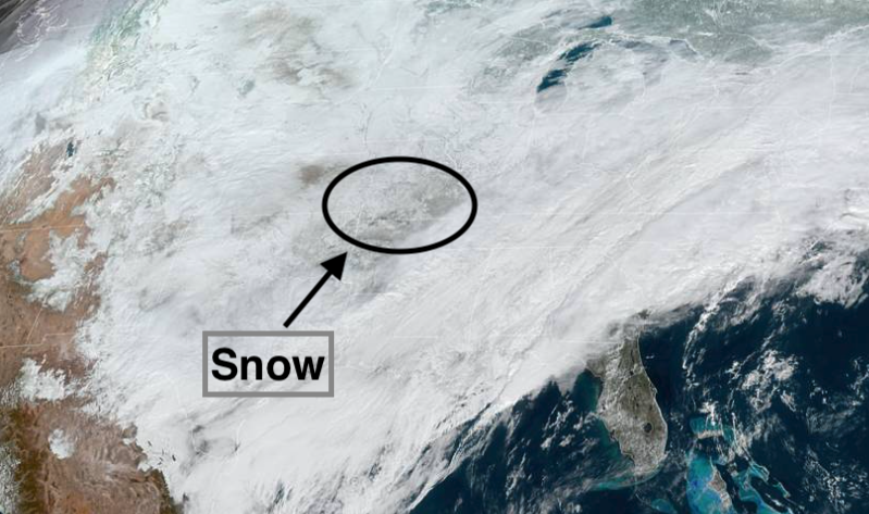
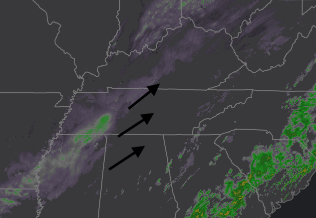
With temperatures across the valley near 40 degrees at the lunch time hour, I think it's safe to say any snow is now gone and melted. Early reports suggest 0.2-0.5 inches were picked up in isolated locations around the valley. Taking a look below, snow can be seen from the "true-color daytime" band from GOES-EAST. Because it is not animated it is hard to distinguish cloud from snow, but I promise it's there. An animated version can be found in our daily video forecast at the bottom of the blog. Looking at the current radar (timestamped 11:50am) another round of moisture will bring a light rain to snow across East Tennessee. This will mainly impact the Plateau and northern half of the state, but don't be surprised to see a few flakes overnight. We finally have some good news ahead as temperatures rebound into the weekend and sunshine finds us back tomorrow afternoon. High pressure builds in late tonight from our west allowing for much needed clearing tomorrow afternoon. Temperatures will manage their way back to average as well with high's Sunday in the low to mid 50's. A quick disturbance looks to bring rain Sunday night into Monday but we should be drying back out by Monday evening. The pattern ahead looks to be much more average with sunshine and 50's to 60's by midweek next week. Black ice will again be an issue for some tonight, so take it easy as we end the work week tomorrow. Much warmer and drier air is head this weekend, so enjoy it. For more details, as well as an animated satellite slide, check out your full video forecast below: Pre-recorded for 5pm show
0 Comments
Leave a Reply. |
Your trusted source for everything weather in East Tennessee.
Social Media
|


