|
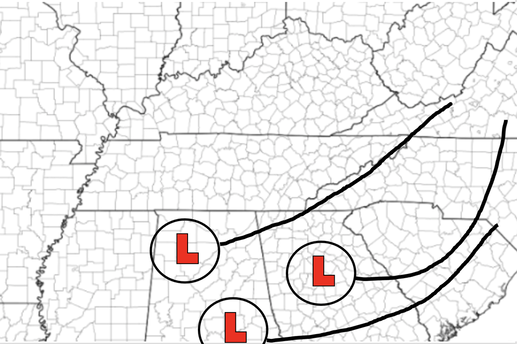
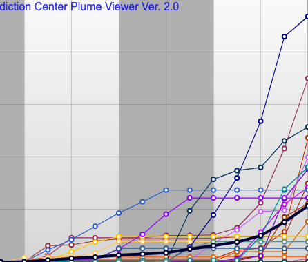
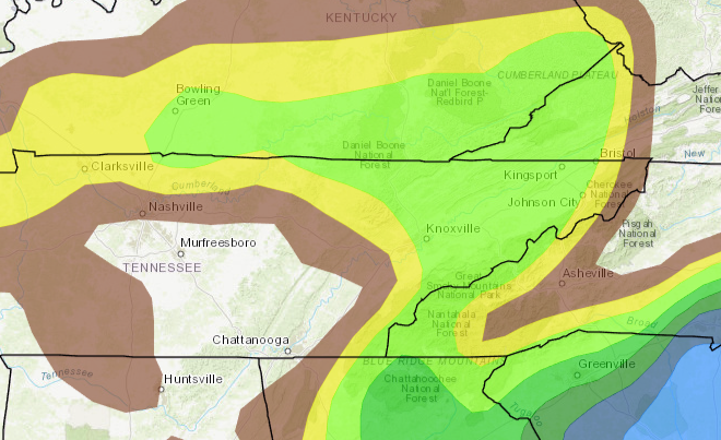
Lots to discuss so I am gonna jump right into it. Winter weather systems are very challenging to forecast in these parts because one (looks like small) variation can actually have a large scale change in reality. Looking below, a sketch of the 3 big global models shows this uncertainty. A more northern track signifies a more rain to snow (on the back side) forecast. A more southern track would mean a better opportunity at snow throughout. Given the large uncertainty still associated, it's hard to provide numbers. Right now, guidance suggests anywhere from no snow to 8 inches of snow depending where you are at.... Diving a bit deeper, plumes are a great example of showing the range of possibilities. In this instance, data suggests snowfall ranges from zero to over 9 inches....these lines will look much closer together (far bottom left of the image) as data converges (better agrees) on a solution. This is all to generally say, lots of uncertainty remains. As higher resolution data comes in and guidances comes into better agreement, we'll have a better idea. Again one change in path, low intensity/development, etc can change a lot in the grand scheme of things. Lastly, examining the probability forecast for ICE, there's a 10-20% chance to see 0.01" or greater. This doesn't seem like much but the current path favors the opportunity for some freezing rain (especially Saturday night). Be sure to continue to check in via Twitter/Facebook and here on the website for better details regarding this system. I anticipate a mix of all precipitation types, but narrowing that in on exact numbers remains too difficult to forecast with accuracy (as of this morning). Here is an example of just one of many model runs depicting the rain to snow/mix. Given the mean path of all models, I anticipate rain to start us off during the day Saturday, transitioning to a mix/freezing rain (possible briefly). Overnight, valleys will see a mix of rain and snow, before transitioning back to rain during the day Sunday. This will be different for elevated locations (Plateau) and especially the Smokies. The Plateau will likely see a better opportunity for snow Saturday night as these locations will be much closer to freezing (32) at the surface. The Smokies overall are expected to see the best snowfall. These will be on the highest locations (3000 ft+). Check in with us tomorrow for better details on precipitation types, snowfall numbers, and who might see what and where. For you winter weather lovers, please don't get caught up in model runs you may see swing around social media. These are NOT forecasts! This is guidance and needs to be taken with a BIG grain of salt. We'll continue to provide better details as they emerge, but for now, anticipate minimal to no accumulations and a more rain with some snow mixing in forecast. Pre-recorded for 5pm show
0 Comments
Leave a Reply. |
Your trusted source for everything weather in East Tennessee.
Social Media
|


