|
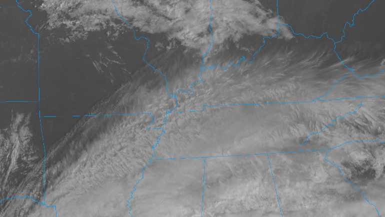
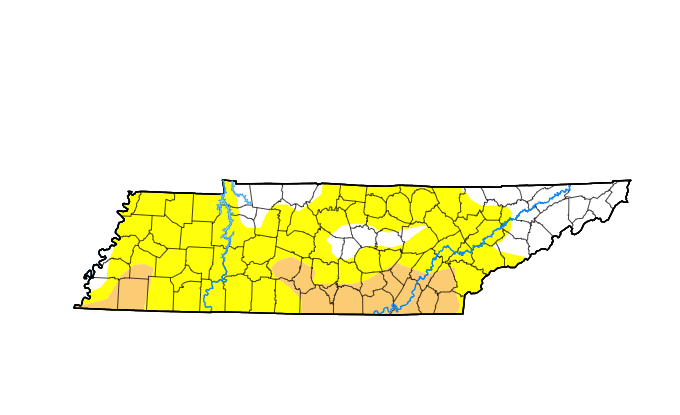
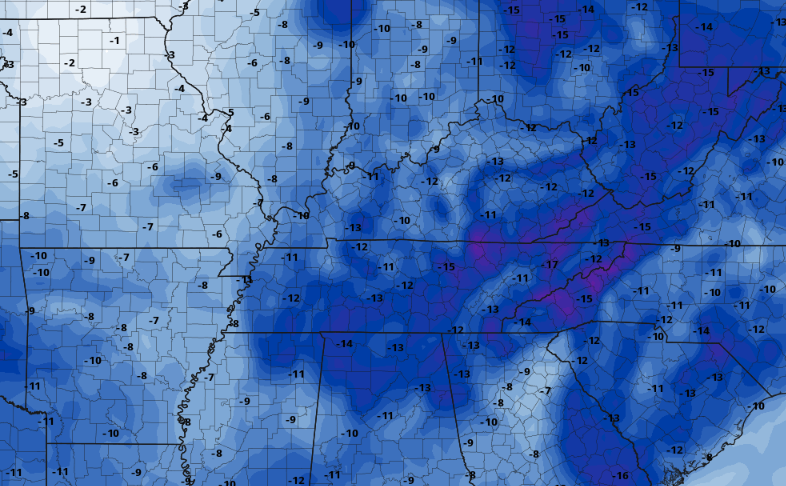
An unsettled and overall cooler pattern will take shape through early next week, with rounds of rain and below average temperatures. As for today, cloud cover continues to push north and east as a system along and just south of the state meanders through. As a result, cloud cover will stick around much of the day, with isolated showers possible for those furthest south. Temperatures will feel cooler as well, with most topping out in the upper 60s to low 70s. Warmer air and more sunshine is on the way for Thursday though, with a change of mid and upper 70s expected tomorrow. Looking at a concern we have mentioned that past couple of weeks: drought. This is the latest release for the state, depicting abnormally dry (yellow) and moderate drought (tan/brown). Rainfall amounts looks to be very minimal over the next week, with amounts up to a quarter of an inch possible. Rainfall will come best Friday night into Saturday, where lingering/annoying cool, cloudy, and isolated showers follow Sunday through at least Tuesday. With below average rainfall set to continue, the concerns for fire issues and related water shortage problems will grow in the weeks to come. So what about this cooler air you are talking about? Well, a strong cold front will bring showers Friday into Saturday followed by a sharp drop in temperatures. Unfortunately, the upper level disturbance will linger across the eastern USA through early next week, resulting in periods of showers, cloud cover, and cooler temperatures overall. Below is a depiction of what we could see by Monday. This image is comparing average temperatures to those of what is expected....meaning we could see highs Monday 10 to 15 degrees below average in many locations. Prepare to bundle up moving forward, dreary fall days look to arrive this weekend. Cloud cover will thin out overnight, leaving partly cloudy skies for your Thursday. Temperatures will be warmer as well, followed by an approaching cold front Friday. This will bring likely showers to the area but with minimal rainfall amounts. Cooler air follows, lasting through at least early to mid week. Pre-recorded for 5pm weather broadcast
0 Comments
Leave a Reply. |
Your trusted source for everything weather in East Tennessee.
Social Media
|


