|
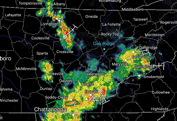
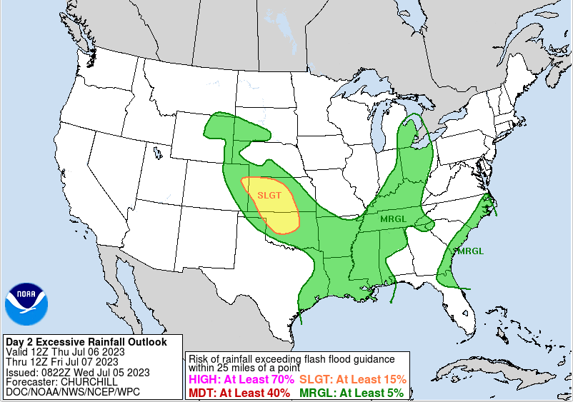
Happy hump day to all! We are starting the morning out with showers and storms, where southern counties have been hit the hardest thus far. Portions of the Chattanooga area are under a flash flooding warning as slow moving and training storms have left 3+ inches across the area. Luckily this is beginning to work out, but scattered activity will remain possible this afternoon to early evening. In terms of temperatures, highs will be tricky. With showers and cloud cover overhead now, we could be limited in achieving mid to upper 80s. That said, if slots of better sunshine find their way in, we could reach these values. Regardless, it's going to feel sticky overall. Moving forward, a cold front will slide towards the area tomorrow. This will allow for scattered to numerous showers and storms Thursday afternoon and into Friday. Briefly "drier" conditions then find us Saturday, though isolated showers remain in the forecast. By Sunday, another disturbance meanders back in bringing our best shot of showers and storms over the next 5 days. With storms to be slow moving, instances (like today) of flash flooding will be possible. This is highlighted by WPC's marginal risk for today and tomorrow, along with Sunday. An isolated strong storm will also can't be something not to completely rule out Thursday into Friday and again Sunday. Even with unsettled weather in the forecast through at least early next week, there will be opportunities for sunshine and drier periods. This will come best the first half of the day tomorrow and again Saturday. Temperatures will be near seasonal norms as well, topping out in the mid to upper 80s each day, though feel warmer with the muggy airmass we have in place. Have a good one! Pre-recorded for 5pm weather broadcast
0 Comments
Leave a Reply. |
Your trusted source for everything weather in East Tennessee.
Social Media
|


