|
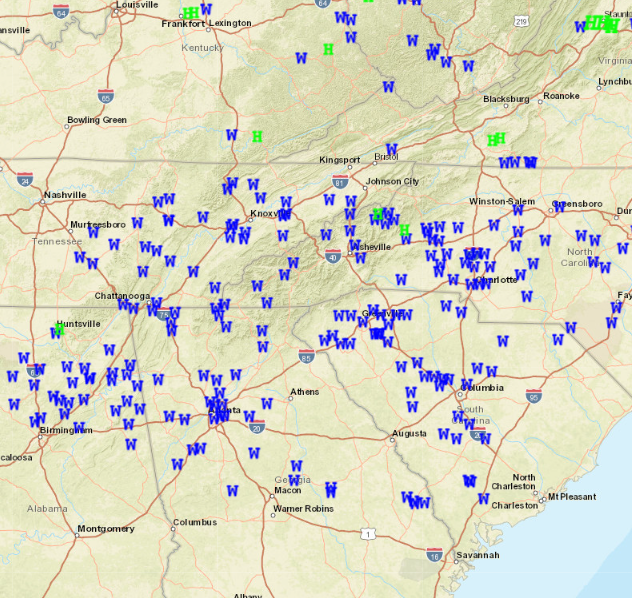
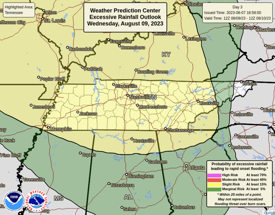
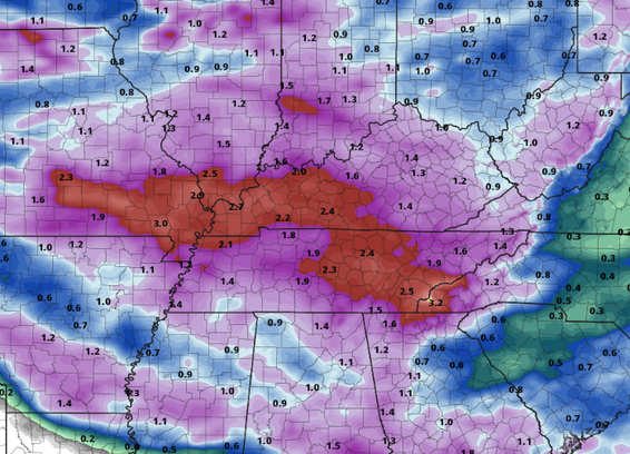
It turned out to be a very busy day across the Southeast, with hundreds of storm reports noted. As you can see below, the bulk of storm damage was in the form of winds, but hail, and possibly a few tornadoes are noted. I say "possible" because several NWS office's (to include Morristown) will be conducting surveys today and Wednesday. Stay tuned for the results of these investigations! As far as today it will be pleasant. Cloud cover will be slow to exit, but once it does so through the morning and early afternoon, partly cloudy skies find us the remainder of the day. Highs will be a touch cooler, thanks to the front, topping out in the low to mid 80s. Moving forward, another disturbance is on the horizon. Thankfully this next system is not nearly as dynamic as the last, but will still pose a severe and flash flooding risk. A two-day flash flooding outlook has been placed across the area, with a slight risk (at least 15% chance) noted both days (Wednesday & Thursday). In terms of rainfall amounts, the average will range from 1-3 inches, with locally higher amounts likely within stronger thunderstorms. Have a way to receive warnings and know what to do late Wednesday and through Thursday. Scattered showers & storms then remain in the forecast Friday and through the weekend, with activity primarily in the afternoon and evening hours late week/weekend. Temperatures will also take a dip mid week (upper 70s to low 80s) followed by a rebound into the mid and upper 80s Friday and through the weekend. That will do it for today. If you have any reports (wind damage, hail, or possible tornado damage), please send that information our way. This information helps us know what is/went on, it helps the NWS with verification/insurance/official claims, along with spreading word to our other viewers on impacts seen. To send reports, mention us on Twitter, Facebook, or send us an email including what happened, where, and roughly what time (if possible). Pictures are ALWAYS welcomed as well!
0 Comments
Leave a Reply. |
Your trusted source for everything weather in East Tennessee.
Social Media
|


