|
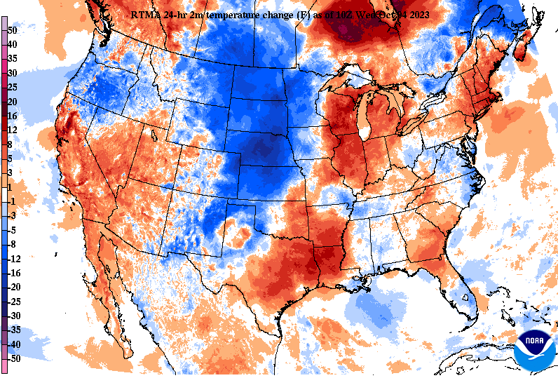
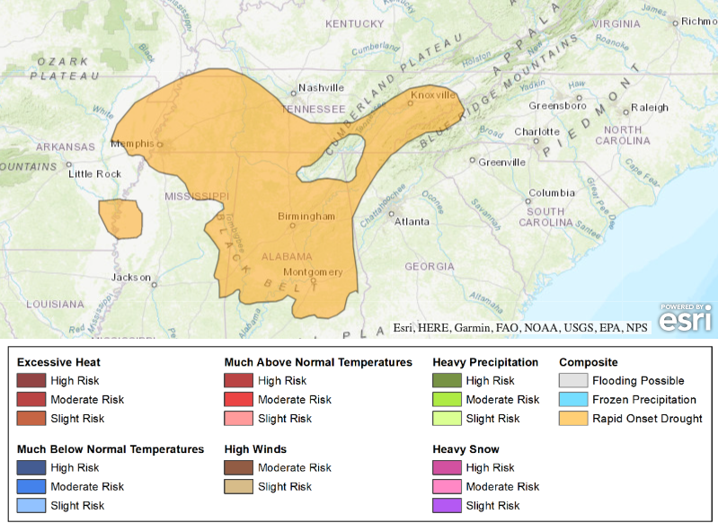
Good morning all! We will start off the day under mostly clear/sunny skies, but quickly see an increase in high coverage into this afternoon. Additional cloud cover will inch in from the west late in the day and overnight, as a disturbance approaches the region. As far as temperatures, one last day of very warm air with highs for many topping out in the mid 80s. Those south of I-65 could even find the upper 80s at a few locations. The good news? BIG changes coming by the weekend. High pressure will begin breaking down today, as a strong cold front approaches from the west. As you can see below, the large blue area signifies the much cooler air post front across the Central Plains. This will slide east, bringing MUCH cooler air to East Tennessee late week. Highs Saturday and Sunday will struggle to break the mid 60s mark, while overnight lows will be very chilly. Values in the upper 30s to low 40s can be expected, with higher terrain closer to freezing. As such, FROST will be an issue for cooler spots this weekend. Make sure to bring in those plants or cover them Saturday and Sunday nights. Aside from the the changing airmass, precipitation will be limited with this system. It will weaken as it sweeps through the Ohio Valley, leaving only isolated to scattered showers. Some may not even see rainfall at all, and those that do, only amounts up to a tenth or two. This is not much when comparing where we should be with rainfall and where we are in reality. Furthermore, the Weather Prediction Center is highlighting "Rapid Onset Drought" for a great portion of TN and south as we get into late October. This is not good, especially as this is our "Fire Season." Rainfall potential after Friday looks very lean and unpromising, so drought is likely to increase/expand in the weeks to come. Hopefully we see a change up later in the month and into November, or we could be dealing with wildfires and other issues in the near future. The forecast remains steady state for today, but the onset of changes will find us tomorrow. A few showers or an isolated storm can't be ruled out Thursday night into Friday, followed by much cooler air into the weekend. Enjoy!
0 Comments
Leave a Reply. |
Your trusted source for everything weather in East Tennessee.
Social Media
|


