|
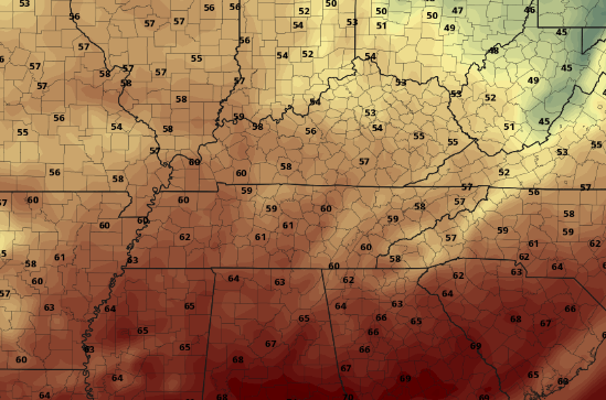
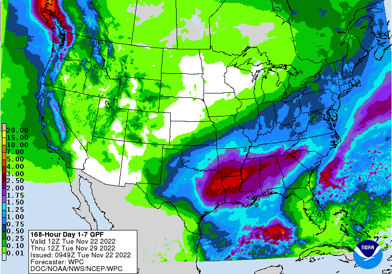
After what has seemed like the start of an early Winter, near seasonal norms will work back in tomorrow. Highs today will range from the mid and upper 50s, with continued warmth pushing temps into the low (and for some) mid 60s Wednesday. Taking a look below, you can see that warmer air filling in across the Southeast. Moving forward, a dynamic weather pattern finds us Thanksgiving evening and through the weekend. Up first, a passing cold front will bring isolated to scattered shower chances late in the day Thanksgiving, followed by a passing area of low pressure. This second system is going to be the rain soaker, where we could see amounts of over an inch in many locations. Timing is still in some what of a question, as guidance is still showing quite a bit of uncertainty. That said, I feel more confident in the arrival of the better rainfall through the day Friday, continuing into the early weekend. Drier air then fills back in later Sunday and into early next week. Here is a look at those rainfall amounts over the next 7 days. Keep in mind drier conditions follow these passing systems, so all the rainfall will be from Thursday evening and through Saturday. The southern flank of the state is expected to see the highest amounts (1.5-2"), while the remainder of the area veers closer to the inch line. Either way, some much needed rainfall for not only the state but the region. For those with Thanksgiving plans, you should stay dry most of the day. We will see showers begin to move in (west to east) toward the evening, before filling in overnight and through Friday. Pre-recorded for 5pm weather broadcast
0 Comments
Leave a Reply. |
Your trusted source for everything weather in East Tennessee.
Social Media
|


