|
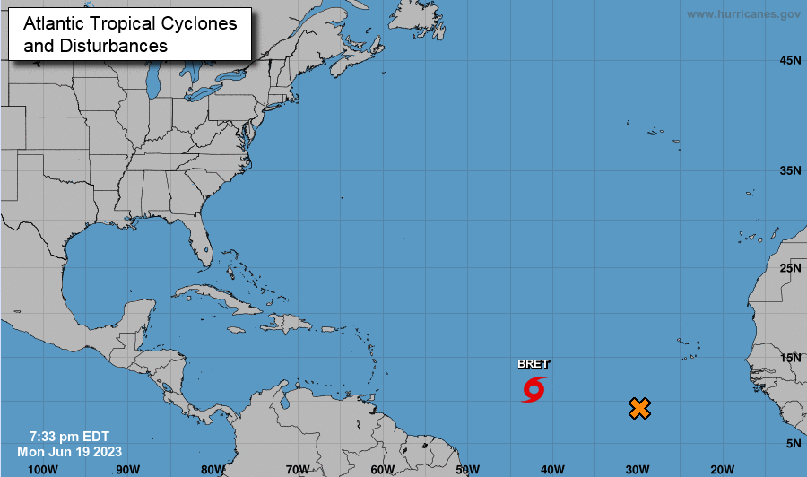
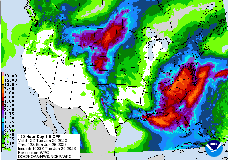
Up first, the Tropics! We have started the season active, where Tropical Storm Bret has now formed. This is expected to drift northwest, heading for the Caribbean. With so much distance and time for it to track, there is uncertainty where this will head, but early indications suggest towards Central America/Mexico. Nonetheless, we will keep you updated on this formation, with a secondary area of concern just off the coast of Africa. The big highlights locally will be the persistent rainfall. An area of low pressure is overhead now, looking to bring rounds of showers and storms today. Areas that saw heavy rainfall yesterday will be the most prone to flash flooding, so have a way to receive alerts if these warnings are issued. Some locations saw as much as 2.5" of rainfall yesterday, while others rounded out near half an inch. Similar circumstances are in the forecast toady, where the heaviest of rainfall should be confined to the Foothills and Smokies. As you can see below, a few more inches of rainfall is in the forecast through late weekend, where some locations could see as much as another 3-4". Take precautions now and have a way to receive alerts, as the flash flooding risk grows by the day. Showers and storms should diminish into the overnight hours each day, with the highest chances during the afternoon and evening hours. Guidance depicts this system to exit a little quicker as it builds back north late work week, meaning dry weather could return as soon as Saturday evening or Sunday. Until then, have the umbrellas handy as waves of showers and storms are forecast with temperatures in the upper 70s to low 80s. Pre-recorded for 5pm weather broadcast
0 Comments
Leave a Reply. |
Your trusted source for everything weather in East Tennessee.
Social Media
|


