|
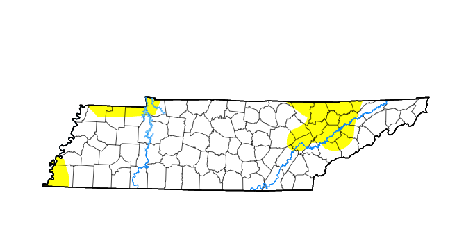
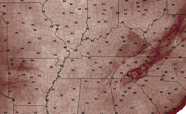
With a lack of rainfall in the past week or more, dry conditions have creeped across the Volunteer State. The expansion of abnormally dry conditions has spread west, with more locations likely added a week from now. This continued "Summer-Like" pattern looks to stick around until at least mid next week. This means any rainfall that does occur will be confined and short lived with isolated pop up afternoon activity through the next several days. Another concern as we build into the day tomorrow and the weekend, will be temperatures. Heat safety will be something to keep in mind for those heading outside for extended periods of time. Be sure to stay hydrated and have the sunscreen on. Temperatures will likely peak in the upper 80s to near 90 tomorrow, finding the low 90s Saturday. Some slight relief returns Monday, with highs "cooling" into the mid 80s. Like yesterday, a few afternoon pop up showers or storms can't be ruled out. These daily, low end chances will remain generally through the weekend, with the bigger risk being the warm air that continues to build in. Have a good one, stay cool & hydrated, and enjoy the day! Pre-recorded for 5pm weather broadcast
0 Comments
Leave a Reply. |
Your trusted source for everything weather in East Tennessee.
Social Media
|


