|
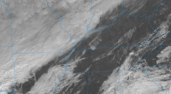
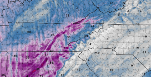
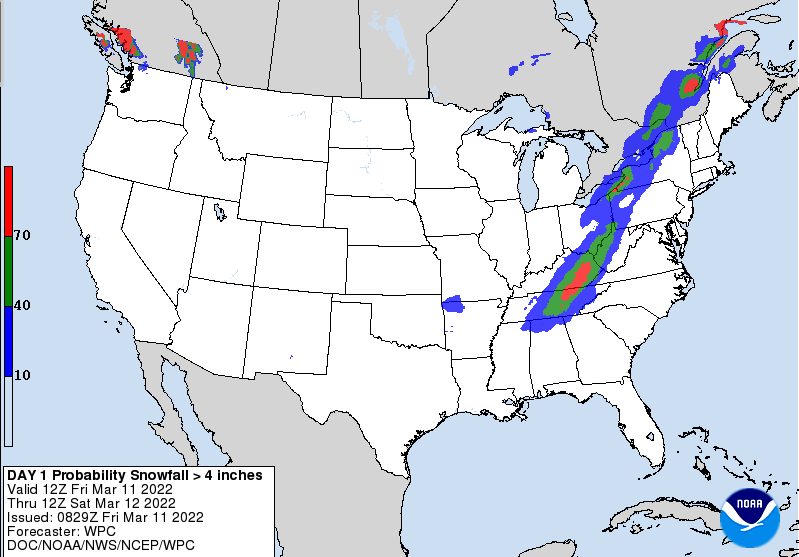
As we close out the work week in the 60s, a whole different world will find us tomorrow. Satellite depicts sunshine and a few clouds across East Tennessee, while to our west a strong cold front is approaching. As it does so, rain showers will turn to snow overnight. Because of this, a Winter Storm Warning has been issued for the greater viewing area. All but the far northeast is under a warning, while these areas are under a winter weather advisory. Looking at this transition, most will see the changeover after midnight. Timing...... Midnight - 2 am for the Plateau 2 am - 4 am for the Valley 4 am - 6 am Foothills/Smokies Given the warm surface temperatures we will have because of this afternoon, this will likely eat into snow totals initially. Given the high snowfall rates associated though, this will help overcome the warmer conditions and lead to accumulations. With that said, our best opportunities for accumulating snow will be on grassy and elevated surfaces. Roadways will be much slower to build snowfall (good news), but if they do so, it could lead to a slushy mess and potential icing by Sunday morning. By the end of the weekend, sunshine returns as well as warmer temperatures and this trend looks to continue into the new work week as well. In addition to the change over, winds will be breezy. Not only will this make for colder feel-like temps, but will also create hazardous visibility conditions. Here is a depiction of some of the wind gusts we could see overnight, ranging from 25 and 35 mph. Lastly, the probability for 4 inches or more is low across the Valley 10-40% but not entirely ruled out. The best opportunity will be across the Plateau and into Eastern Kentucky. With all of this said, accumulations have been bumped up a bit. Given the better snowfall rates associated with this front, valley locations can anticipate between 2 and 3 inches, with the southern valley between 1 and 3 inches. The plateau will have the best opportunity, with 3-6+ inches possible. All will face a driving danger, as slick roads and reduced visibilities (overnight) will be present. Send us snowfall reports as well as pictures by tagging us on Twitter or Facebook (@SecretCityWx) or by emailing us. Be safe, stay warm, and have a good weekend! Pre-recorded for 5pm show
0 Comments
Leave a Reply. |
Your trusted source for everything weather in East Tennessee.
Social Media
|


